F15A Butte, MT, USA - Earthquake Result Viewer
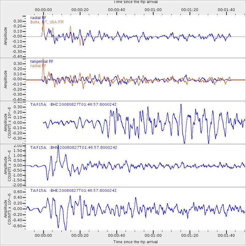
Earthquake location: Lake Baykal Region, Russia
Earthquake latitude/longitude: 51.6/104.2
Earthquake time(UTC): 2008/08/27 (240) 01:35:32 GMT
Earthquake Depth: 16 km
Earthquake Magnitude: 5.8 MB, 6.2 MS, 6.2 MW, 6.2 MW
Earthquake Catalog/Contributor: WHDF/NEIC
Network: TA USArray Transportable Network (new EarthScope stations)
Station: F15A Butte, MT, USA
Lat/Lon: 45.84 N/112.49 W
Elevation: 1995 m
Distance: 77.9 deg
Az: 25.261 deg
Baz: 337.624 deg
Ray Param: 0.049981665
Estimated Moho Depth: 33.75 km
Estimated Crust Vp/Vs: 1.60
Assumed Crust Vp: 6.577 km/s
Estimated Crust Vs: 4.111 km/s
Estimated Crust Poisson's Ratio: 0.18
Radial Match: 90.01099 %
Radial Bump: 400
Transverse Match: 83.339485 %
Transverse Bump: 400
SOD ConfigId: 2504
Insert Time: 2010-03-06 04:54:43.929 +0000
GWidth: 2.5
Max Bumps: 400
Tol: 0.001

Signal To Noise

ChannelStoNSTALTA
TA:F15A: :BHN:20080827T01:46:57.800024Z10.32440956.306413E-76.108255E-8
TA:F15A: :BHE:20080827T01:46:57.800024Z4.20635751.8594498E-74.4205702E-8
TA:F15A: :BHZ:20080827T01:46:57.800024Z1.90631478.361791E-84.3863647E-8
Arrivals
Ps3.2 SECOND
PpPs13 SECOND
PsPs/PpSs16 SECOND