You are here: Home > Network List > TA - USArray Transportable Network (new EarthScope stations) Stations List
> Station BGNE Belgrade, NE, USA > Earthquake Result Viewer
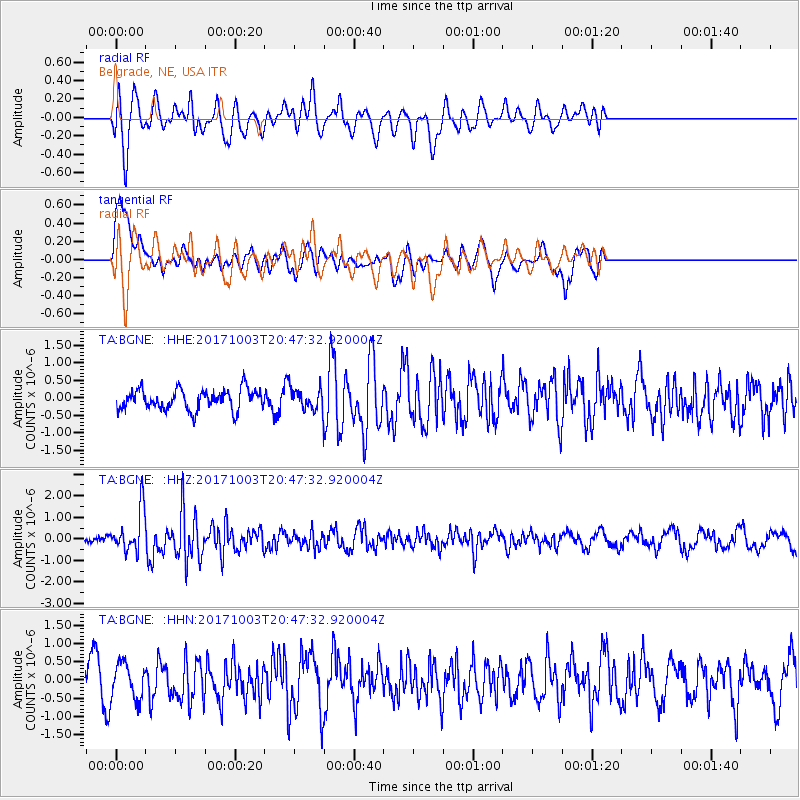
BGNE Belgrade, NE, USA - Earthquake Result Viewer
*The percent match for this event was below the threshold and hence no stack was calculated.
| Earthquake location: |
North Atlantic Ocean |
| Earthquake latitude/longitude: |
13.5/-49.3 |
| Earthquake time(UTC): |
2017/10/03 (276) 20:39:04 GMT |
| Earthquake Depth: |
10 km |
| Earthquake Magnitude: |
5.7 Mww |
| Earthquake Catalog/Contributor: |
NEIC PDE/us |
|
| Network: |
TA USArray Transportable Network (new EarthScope stations) |
| Station: |
BGNE Belgrade, NE, USA |
| Lat/Lon: |
41.41 N/98.15 W |
| Elevation: |
573 m |
|
| Distance: |
50.6 deg |
| Az: |
312.921 deg |
| Baz: |
108.713 deg |
| Ray Param: |
$rayparam |
*The percent match for this event was below the threshold and hence was not used in the summary stack. |
|
| Radial Match: |
66.74076 % |
| Radial Bump: |
400 |
| Transverse Match: |
70.224365 % |
| Transverse Bump: |
400 |
| SOD ConfigId: |
13570011 |
| Insert Time: |
2019-04-28 22:13:27.472 +0000 |
| GWidth: |
2.5 |
| Max Bumps: |
400 |
| Tol: |
0.001 |
|
Signal To Noise
| Channel | StoN | STA | LTA |
| TA:BGNE: :HHZ:20171003T20:47:32.920004Z | 5.082915 | 9.815834E-7 | 1.9311427E-7 |
| TA:BGNE: :HHN:20171003T20:47:32.920004Z | 1.0272096 | 4.7944536E-7 | 4.6674538E-7 |
| TA:BGNE: :HHE:20171003T20:47:32.920004Z | 1.2837143 | 3.7344145E-7 | 2.90907E-7 |
| Arrivals |
| Ps | |
| PpPs | |
| PsPs/PpSs | |


