You are here: Home > Network List > TA - USArray Transportable Network (new EarthScope stations) Stations List
> Station G31M Satah River, YT, CAN > Earthquake Result Viewer
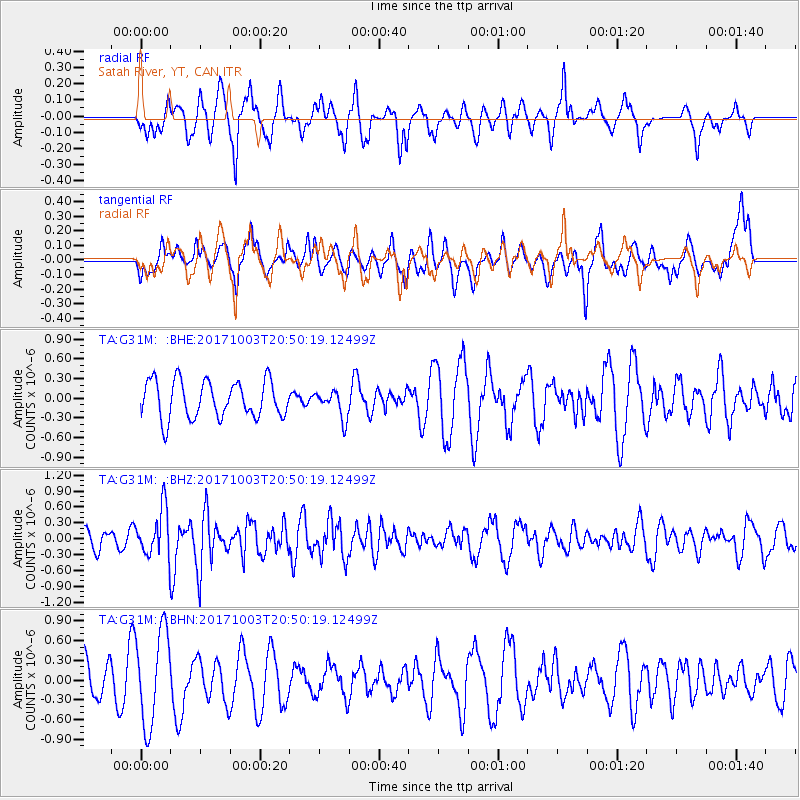
G31M Satah River, YT, CAN - Earthquake Result Viewer
*The percent match for this event was below the threshold and hence no stack was calculated.
| Earthquake location: |
North Atlantic Ocean |
| Earthquake latitude/longitude: |
13.5/-49.3 |
| Earthquake time(UTC): |
2017/10/03 (276) 20:39:04 GMT |
| Earthquake Depth: |
10 km |
| Earthquake Magnitude: |
5.7 Mww |
| Earthquake Catalog/Contributor: |
NEIC PDE/us |
|
| Network: |
TA USArray Transportable Network (new EarthScope stations) |
| Station: |
G31M Satah River, YT, CAN |
| Lat/Lon: |
66.92 N/134.27 W |
| Elevation: |
61 m |
|
| Distance: |
75.7 deg |
| Az: |
336.099 deg |
| Baz: |
89.263 deg |
| Ray Param: |
$rayparam |
*The percent match for this event was below the threshold and hence was not used in the summary stack. |
|
| Radial Match: |
65.05202 % |
| Radial Bump: |
400 |
| Transverse Match: |
41.458046 % |
| Transverse Bump: |
400 |
| SOD ConfigId: |
13570011 |
| Insert Time: |
2019-04-28 22:13:38.812 +0000 |
| GWidth: |
2.5 |
| Max Bumps: |
400 |
| Tol: |
0.001 |
|
Signal To Noise
| Channel | StoN | STA | LTA |
| TA:G31M: :BHZ:20171003T20:50:19.12499Z | 2.9691377 | 4.5030765E-7 | 1.5166277E-7 |
| TA:G31M: :BHN:20171003T20:50:19.12499Z | 2.4560966 | 7.098092E-7 | 2.889989E-7 |
| TA:G31M: :BHE:20171003T20:50:19.12499Z | 0.73617166 | 2.0786779E-7 | 2.823632E-7 |
| Arrivals |
| Ps | |
| PpPs | |
| PsPs/PpSs | |


