You are here: Home > Network List > TA - USArray Transportable Network (new EarthScope stations) Stations List
> Station H31M Peel River, Yukon, CAN > Earthquake Result Viewer
H31M Peel River, Yukon, CAN - Earthquake Result Viewer
*The percent match for this event was below the threshold and hence no stack was calculated.
| Earthquake location: |
North Atlantic Ocean |
| Earthquake latitude/longitude: |
13.5/-49.3 |
| Earthquake time(UTC): |
2017/10/03 (276) 20:39:04 GMT |
| Earthquake Depth: |
10 km |
| Earthquake Magnitude: |
5.7 Mww |
| Earthquake Catalog/Contributor: |
NEIC PDE/us |
|
| Network: |
TA USArray Transportable Network (new EarthScope stations) |
| Station: |
H31M Peel River, Yukon, CAN |
| Lat/Lon: |
65.81 N/134.34 W |
| Elevation: |
642 m |
|
| Distance: |
75.8 deg |
| Az: |
334.942 deg |
| Baz: |
88.913 deg |
| Ray Param: |
$rayparam |
*The percent match for this event was below the threshold and hence was not used in the summary stack. |
|
| Radial Match: |
50.064106 % |
| Radial Bump: |
400 |
| Transverse Match: |
42.773228 % |
| Transverse Bump: |
400 |
| SOD ConfigId: |
13570011 |
| Insert Time: |
2019-04-28 22:13:41.289 +0000 |
| GWidth: |
2.5 |
| Max Bumps: |
400 |
| Tol: |
0.001 |
|
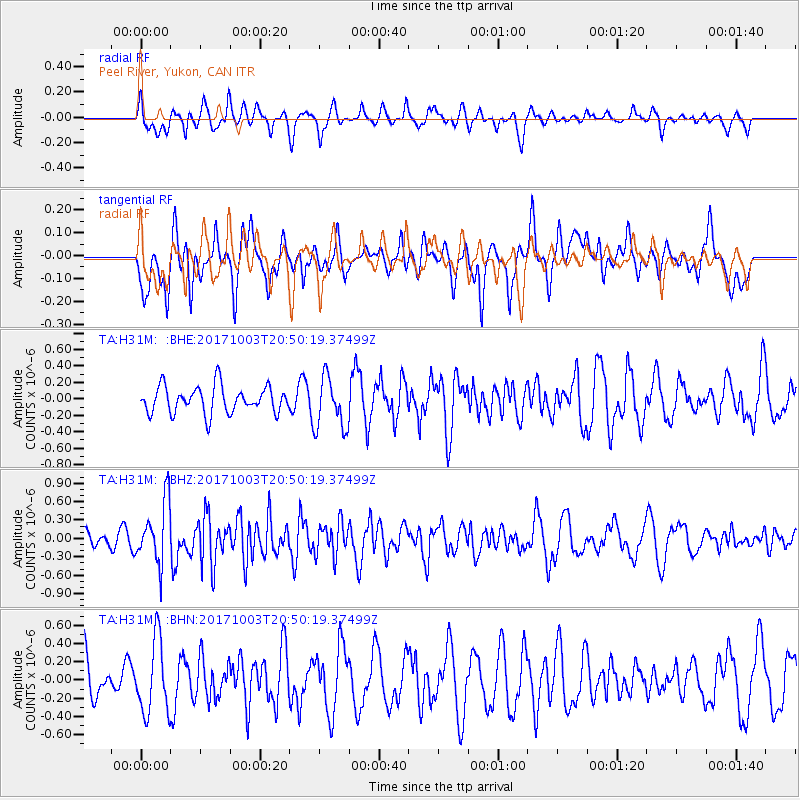
Signal To Noise
| Channel | StoN | STA | LTA |
| TA:H31M: :BHZ:20171003T20:50:19.37499Z | 3.6093228 | 5.0532066E-7 | 1.4000427E-7 |
| TA:H31M: :BHN:20171003T20:50:19.37499Z | 1.2803138 | 4.028728E-7 | 3.146672E-7 |
| TA:H31M: :BHE:20171003T20:50:19.37499Z | 1.9358646 | 3.1397812E-7 | 1.6219012E-7 |
| Arrivals |
| Ps | |
| PpPs | |
| PsPs/PpSs | |


