You are here: Home > Network List > UW - Pacific Northwest Regional Seismic Network Stations List
> Station FISH Seaside, OR, USA > Earthquake Result Viewer
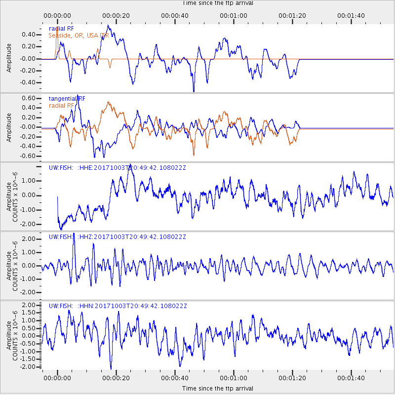
FISH Seaside, OR, USA - Earthquake Result Viewer
*The percent match for this event was below the threshold and hence no stack was calculated.
| Earthquake location: |
North Atlantic Ocean |
| Earthquake latitude/longitude: |
13.5/-49.3 |
| Earthquake time(UTC): |
2017/10/03 (276) 20:39:04 GMT |
| Earthquake Depth: |
10 km |
| Earthquake Magnitude: |
5.7 Mww |
| Earthquake Catalog/Contributor: |
NEIC PDE/us |
|
| Network: |
UW Pacific Northwest Regional Seismic Network |
| Station: |
FISH Seaside, OR, USA |
| Lat/Lon: |
45.93 N/123.56 W |
| Elevation: |
325 m |
|
| Distance: |
69.5 deg |
| Az: |
314.188 deg |
| Baz: |
91.705 deg |
| Ray Param: |
$rayparam |
*The percent match for this event was below the threshold and hence was not used in the summary stack. |
|
| Radial Match: |
17.119965 % |
| Radial Bump: |
400 |
| Transverse Match: |
34.718353 % |
| Transverse Bump: |
400 |
| SOD ConfigId: |
13570011 |
| Insert Time: |
2019-04-28 22:14:45.657 +0000 |
| GWidth: |
2.5 |
| Max Bumps: |
400 |
| Tol: |
0.001 |
|
Signal To Noise
| Channel | StoN | STA | LTA |
| UW:FISH: :HHZ:20171003T20:49:42.108022Z | 1.6547228 | 4.7983525E-7 | 2.8997925E-7 |
| UW:FISH: :HHN:20171003T20:49:42.108022Z | 2.365878 | 1.3275702E-6 | 5.6113214E-7 |
| UW:FISH: :HHE:20171003T20:49:42.108022Z | 1.1398685 | 1.2445621E-6 | 1.0918471E-6 |
| Arrivals |
| Ps | |
| PpPs | |
| PsPs/PpSs | |


