F15A Butte, MT, USA - Earthquake Result Viewer
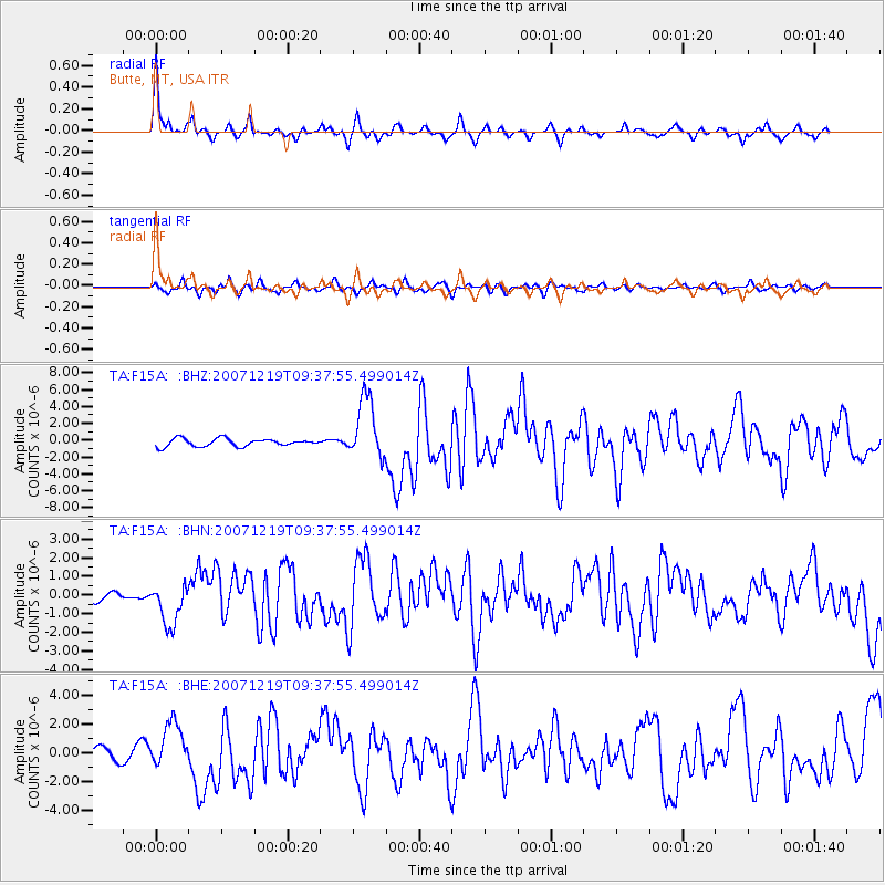
Earthquake location: Andreanof Islands, Aleutian Is.
Earthquake latitude/longitude: 51.4/-179.5
Earthquake time(UTC): 2007/12/19 (353) 09:30:27 GMT
Earthquake Depth: 29 km
Earthquake Magnitude: 6.4 MB, 7.1 MS, 7.1 MW, 7.0 MW
Earthquake Catalog/Contributor: WHDF/NEIC
Network: TA USArray Transportable Network (new EarthScope stations)
Station: F15A Butte, MT, USA
Lat/Lon: 45.84 N/112.49 W
Elevation: 1995 m
Distance: 43.3 deg
Az: 69.882 deg
Baz: 302.635 deg
Ray Param: 0.07260372
Estimated Moho Depth: 32.5 km
Estimated Crust Vp/Vs: 2.07
Assumed Crust Vp: 6.577 km/s
Estimated Crust Vs: 3.181 km/s
Estimated Crust Poisson's Ratio: 0.35
Radial Match: 87.10448 %
Radial Bump: 339
Transverse Match: 73.38433 %
Transverse Bump: 400
SOD ConfigId: 2564
Insert Time: 2010-03-06 04:55:35.533 +0000
GWidth: 2.5
Max Bumps: 400
Tol: 0.001

Signal To Noise

ChannelStoNSTALTA
TA:F15A: :BHN:20071219T09:37:55.499014Z3.30545161.1221938E-63.3949786E-7
TA:F15A: :BHE:20071219T09:37:55.499014Z3.8483371.5762442E-64.0959102E-7
TA:F15A: :BHZ:20071219T09:37:55.499014Z8.082813.6369395E-64.4995977E-7
Arrivals
Ps5.6 SECOND
PpPs14 SECOND
PsPs/PpSs20 SECOND