You are here: Home > Network List > IU - Global Seismograph Network (GSN - IRIS/USGS) Stations List
> Station FURI Mt. Furi, Ethiopia > Earthquake Result Viewer
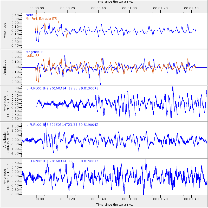
FURI Mt. Furi, Ethiopia - Earthquake Result Viewer
*The percent match for this event was below the threshold and hence no stack was calculated.
| Earthquake location: |
Southwest Of Africa |
| Earthquake latitude/longitude: |
-52.6/18.9 |
| Earthquake time(UTC): |
2016/03/14 (074) 23:25:40 GMT |
| Earthquake Depth: |
10 km |
| Earthquake Magnitude: |
5.8 MWP |
| Earthquake Catalog/Contributor: |
NEIC PDE/NEIC COMCAT |
|
| Network: |
IU Global Seismograph Network (GSN - IRIS/USGS) |
| Station: |
FURI Mt. Furi, Ethiopia |
| Lat/Lon: |
8.90 N/38.68 E |
| Elevation: |
2570 m |
|
| Distance: |
63.6 deg |
| Az: |
21.97 deg |
| Baz: |
193.34 deg |
| Ray Param: |
$rayparam |
*The percent match for this event was below the threshold and hence was not used in the summary stack. |
|
| Radial Match: |
74.080345 % |
| Radial Bump: |
400 |
| Transverse Match: |
72.105576 % |
| Transverse Bump: |
400 |
| SOD ConfigId: |
1453031 |
| Insert Time: |
2016-03-28 23:41:02.375 +0000 |
| GWidth: |
2.5 |
| Max Bumps: |
400 |
| Tol: |
0.001 |
|
Signal To Noise
| Channel | StoN | STA | LTA |
| IU:FURI:00:BHZ:20160314T23:35:39.819004Z | 2.7467363 | 3.1621744E-7 | 1.151248E-7 |
| IU:FURI:00:BH1:20160314T23:35:39.819004Z | 1.308812 | 1.5198779E-7 | 1.1612652E-7 |
| IU:FURI:00:BH2:20160314T23:35:39.819004Z | 1.1818352 | 1.2164655E-7 | 1.02930215E-7 |
| Arrivals |
| Ps | |
| PpPs | |
| PsPs/PpSs | |


