F15A Butte, MT, USA - Earthquake Result Viewer
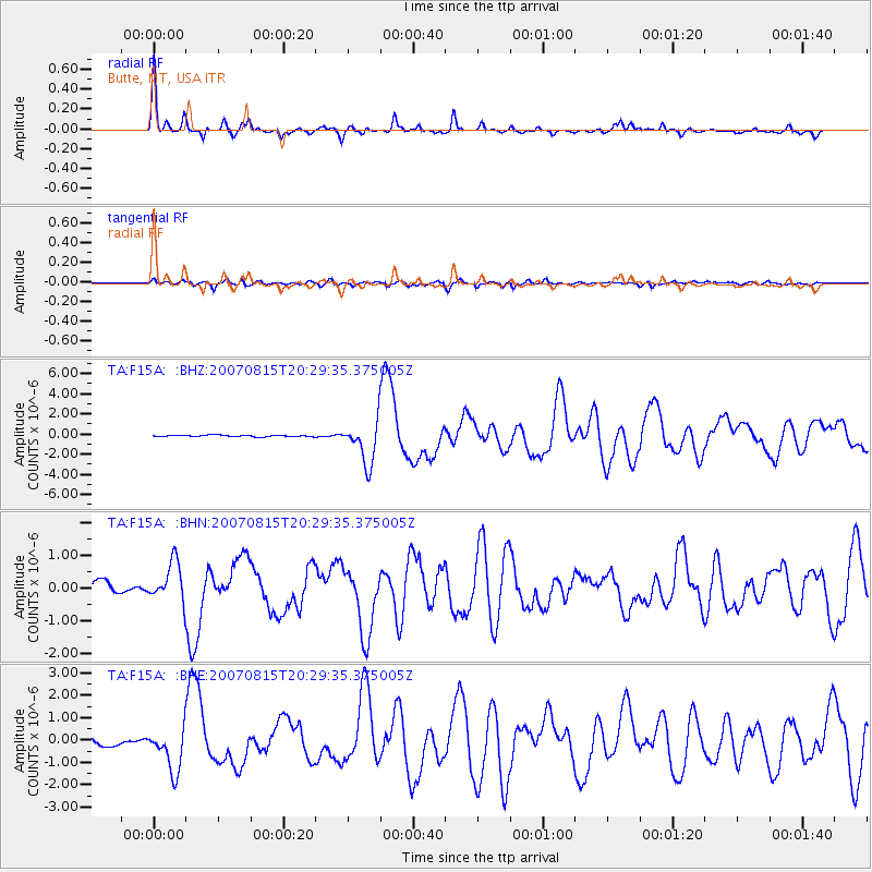
Earthquake location: Andreanof Islands, Aleutian Is.
Earthquake latitude/longitude: 50.3/-177.5
Earthquake time(UTC): 2007/08/15 (227) 20:22:11 GMT
Earthquake Depth: 9.0 km
Earthquake Magnitude: 6.3 MB, 6.2 MS, 6.4 MW, 5.9 ML
Earthquake Catalog/Contributor: WHDF/NEIC
Network: TA USArray Transportable Network (new EarthScope stations)
Station: F15A Butte, MT, USA
Lat/Lon: 45.84 N/112.49 W
Elevation: 1995 m
Distance: 42.5 deg
Az: 69.89 deg
Baz: 300.564 deg
Ray Param: 0.07316804
Estimated Moho Depth: 37.25 km
Estimated Crust Vp/Vs: 1.81
Assumed Crust Vp: 6.577 km/s
Estimated Crust Vs: 3.634 km/s
Estimated Crust Poisson's Ratio: 0.28
Radial Match: 91.46923 %
Radial Bump: 278
Transverse Match: 72.111824 %
Transverse Bump: 400
SOD ConfigId: 2564
Insert Time: 2010-03-06 04:56:10.034 +0000
GWidth: 2.5
Max Bumps: 400
Tol: 0.001

Signal To Noise

ChannelStoNSTALTA
TA:F15A: :BHN:20070815T20:29:35.375005Z3.55836995.932881E-71.667303E-7
TA:F15A: :BHE:20070815T20:29:35.375005Z7.3115149.58251E-71.3106055E-7
TA:F15A: :BHZ:20070815T20:29:35.375005Z27.5925432.1254182E-67.702872E-8
Arrivals
Ps4.9 SECOND
PpPs15 SECOND
PsPs/PpSs20 SECOND