You are here: Home > Network List > AZ - ANZA Regional Network Stations List
> Station PFO AZ.PFO > Earthquake Result Viewer
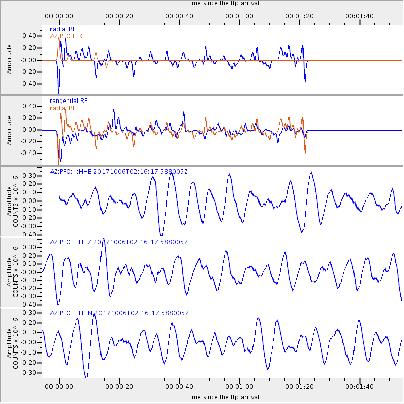
PFO AZ.PFO - Earthquake Result Viewer
*The percent match for this event was below the threshold and hence no stack was calculated.
| Earthquake location: |
Central Mid-Atlantic Ridge |
| Earthquake latitude/longitude: |
1.0/-25.5 |
| Earthquake time(UTC): |
2017/10/06 (279) 02:03:48 GMT |
| Earthquake Depth: |
10 km |
| Earthquake Magnitude: |
5.5 Mww |
| Earthquake Catalog/Contributor: |
NEIC PDE/us |
|
| Network: |
AZ ANZA Regional Network |
| Station: |
PFO AZ.PFO |
| Lat/Lon: |
33.61 N/116.46 W |
| Elevation: |
1259 m |
|
| Distance: |
90.3 deg |
| Az: |
303.445 deg |
| Baz: |
88.684 deg |
| Ray Param: |
$rayparam |
*The percent match for this event was below the threshold and hence was not used in the summary stack. |
|
| Radial Match: |
49.25404 % |
| Radial Bump: |
400 |
| Transverse Match: |
57.389812 % |
| Transverse Bump: |
400 |
| SOD ConfigId: |
13570011 |
| Insert Time: |
2019-04-28 22:23:21.774 +0000 |
| GWidth: |
2.5 |
| Max Bumps: |
400 |
| Tol: |
0.001 |
|
Signal To Noise
| Channel | StoN | STA | LTA |
| AZ:PFO: :HHZ:20171006T02:16:17.588005Z | 1.9588062 | 2.1268332E-7 | 1.08578035E-7 |
| AZ:PFO: :HHN:20171006T02:16:17.588005Z | 0.9749673 | 1.18734E-7 | 1.2178255E-7 |
| AZ:PFO: :HHE:20171006T02:16:17.588005Z | 4.0842113 | 2.549799E-7 | 6.243064E-8 |
| Arrivals |
| Ps | |
| PpPs | |
| PsPs/PpSs | |


