F15A Butte, MT, USA - Earthquake Result Viewer
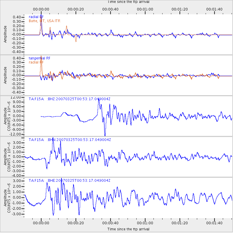
Earthquake location: Near West Coast Of Honshu, Japan
Earthquake latitude/longitude: 37.3/136.6
Earthquake time(UTC): 2007/03/25 (084) 00:41:57 GMT
Earthquake Depth: 8.0 km
Earthquake Magnitude: 6.1 MB, 6.8 MS, 6.7 MW, 6.6 MW
Earthquake Catalog/Contributor: WHDF/NEIC
Network: TA USArray Transportable Network (new EarthScope stations)
Station: F15A Butte, MT, USA
Lat/Lon: 45.84 N/112.49 W
Elevation: 1995 m
Distance: 76.5 deg
Az: 42.179 deg
Baz: 310.043 deg
Ray Param: 0.050934523
Estimated Moho Depth: 39.0 km
Estimated Crust Vp/Vs: 1.90
Assumed Crust Vp: 6.577 km/s
Estimated Crust Vs: 3.452 km/s
Estimated Crust Poisson's Ratio: 0.31
Radial Match: 92.4561 %
Radial Bump: 400
Transverse Match: 90.61675 %
Transverse Bump: 400
SOD ConfigId: 2564
Insert Time: 2010-03-06 04:56:44.945 +0000
GWidth: 2.5
Max Bumps: 400
Tol: 0.001

Signal To Noise

ChannelStoNSTALTA
TA:F15A: :BHN:20070325T00:53:17.049004Z6.4796821.0567019E-61.6307928E-7
TA:F15A: :BHE:20070325T00:53:17.049004Z2.86697051.3278668E-64.6316023E-7
TA:F15A: :BHZ:20070325T00:53:17.049004Z3.60730034.925381E-61.3653924E-6
Arrivals
Ps5.5 SECOND
PpPs17 SECOND
PsPs/PpSs22 SECOND