You are here: Home > Network List > TA - USArray Transportable Network (new EarthScope stations) Stations List
> Station G31M Satah River, YT, CAN > Earthquake Result Viewer
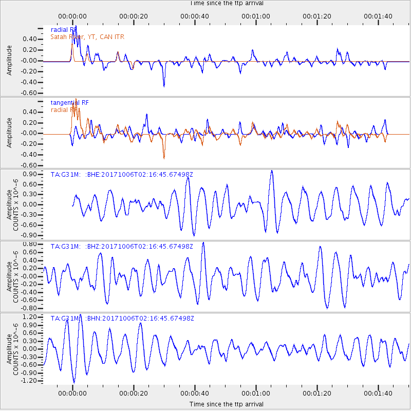
G31M Satah River, YT, CAN - Earthquake Result Viewer
*The percent match for this event was below the threshold and hence no stack was calculated.
| Earthquake location: |
Central Mid-Atlantic Ridge |
| Earthquake latitude/longitude: |
1.0/-25.5 |
| Earthquake time(UTC): |
2017/10/06 (279) 02:03:48 GMT |
| Earthquake Depth: |
10 km |
| Earthquake Magnitude: |
5.5 Mww |
| Earthquake Catalog/Contributor: |
NEIC PDE/us |
|
| Network: |
TA USArray Transportable Network (new EarthScope stations) |
| Station: |
G31M Satah River, YT, CAN |
| Lat/Lon: |
66.92 N/134.27 W |
| Elevation: |
61 m |
|
| Distance: |
96.4 deg |
| Az: |
337.938 deg |
| Baz: |
72.303 deg |
| Ray Param: |
$rayparam |
*The percent match for this event was below the threshold and hence was not used in the summary stack. |
|
| Radial Match: |
52.21864 % |
| Radial Bump: |
369 |
| Transverse Match: |
47.71607 % |
| Transverse Bump: |
327 |
| SOD ConfigId: |
13570011 |
| Insert Time: |
2019-04-28 22:28:44.542 +0000 |
| GWidth: |
2.5 |
| Max Bumps: |
400 |
| Tol: |
0.001 |
|
Signal To Noise
| Channel | StoN | STA | LTA |
| TA:G31M: :BHZ:20171006T02:16:45.67498Z | 0.6475267 | 1.4913536E-7 | 2.3031538E-7 |
| TA:G31M: :BHN:20171006T02:16:45.67498Z | 3.190453 | 8.42458E-7 | 2.6405593E-7 |
| TA:G31M: :BHE:20171006T02:16:45.67498Z | 1.2211949 | 2.6151213E-7 | 2.1414446E-7 |
| Arrivals |
| Ps | |
| PpPs | |
| PsPs/PpSs | |


