You are here: Home > Network List > TA - USArray Transportable Network (new EarthScope stations) Stations List
> Station F15A Butte, MT, USA > Earthquake Result Viewer
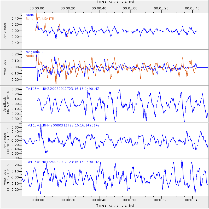
F15A Butte, MT, USA - Earthquake Result Viewer
*The percent match for this event was below the threshold and hence no stack was calculated.
| Earthquake location: |
Komandorskiye Ostrova Region |
| Earthquake latitude/longitude: |
56.3/164.1 |
| Earthquake time(UTC): |
2008/09/12 (256) 23:07:50 GMT |
| Earthquake Depth: |
9.3 km |
| Earthquake Magnitude: |
5.5 MB, 5.7 MS, 5.9 MW, 5.9 MW |
| Earthquake Catalog/Contributor: |
WHDF/NEIC |
|
| Network: |
TA USArray Transportable Network (new EarthScope stations) |
| Station: |
F15A Butte, MT, USA |
| Lat/Lon: |
45.84 N/112.49 W |
| Elevation: |
1995 m |
|
| Distance: |
50.3 deg |
| Az: |
64.448 deg |
| Baz: |
314.004 deg |
| Ray Param: |
$rayparam |
*The percent match for this event was below the threshold and hence was not used in the summary stack. |
|
| Radial Match: |
65.995514 % |
| Radial Bump: |
400 |
| Transverse Match: |
51.775555 % |
| Transverse Bump: |
400 |
| SOD ConfigId: |
2560 |
| Insert Time: |
2010-03-06 04:57:46.300 +0000 |
| GWidth: |
2.5 |
| Max Bumps: |
400 |
| Tol: |
0.001 |
|
Signal To Noise
| Channel | StoN | STA | LTA |
| TA:F15A: :BHN:20080912T23:16:16.149014Z | 2.74323 | 2.8425654E-7 | 1.03621105E-7 |
| TA:F15A: :BHE:20080912T23:16:16.149014Z | 1.8924309 | 1.336857E-7 | 7.0642315E-8 |
| TA:F15A: :BHZ:20080912T23:16:16.149014Z | 1.615189 | 1.4801398E-7 | 9.16388E-8 |
| Arrivals |
| Ps | |
| PpPs | |
| PsPs/PpSs | |


