You are here: Home > Network List > TA - USArray Transportable Network (new EarthScope stations) Stations List
> Station F15A Butte, MT, USA > Earthquake Result Viewer
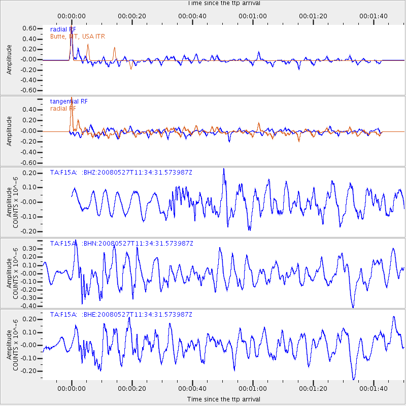
F15A Butte, MT, USA - Earthquake Result Viewer
*The percent match for this event was below the threshold and hence no stack was calculated.
| Earthquake location: |
Near Coast Of Guatemala |
| Earthquake latitude/longitude: |
13.6/-91.0 |
| Earthquake time(UTC): |
2008/05/27 (148) 11:27:55 GMT |
| Earthquake Depth: |
26 km |
| Earthquake Magnitude: |
5.7 MW, 5.1 MS, 5.3 MB, 5.6 MW |
| Earthquake Catalog/Contributor: |
WHDF/NEIC |
|
| Network: |
TA USArray Transportable Network (new EarthScope stations) |
| Station: |
F15A Butte, MT, USA |
| Lat/Lon: |
45.84 N/112.49 W |
| Elevation: |
1995 m |
|
| Distance: |
36.9 deg |
| Az: |
334.769 deg |
| Baz: |
143.64 deg |
| Ray Param: |
$rayparam |
*The percent match for this event was below the threshold and hence was not used in the summary stack. |
|
| Radial Match: |
70.55452 % |
| Radial Bump: |
400 |
| Transverse Match: |
68.14159 % |
| Transverse Bump: |
400 |
| SOD ConfigId: |
2504 |
| Insert Time: |
2010-03-06 04:57:57.450 +0000 |
| GWidth: |
2.5 |
| Max Bumps: |
400 |
| Tol: |
0.001 |
|
Signal To Noise
| Channel | StoN | STA | LTA |
| TA:F15A: :BHN:20080527T11:34:31.573987Z | 3.1411364 | 2.0074734E-7 | 6.390914E-8 |
| TA:F15A: :BHE:20080527T11:34:31.573987Z | 1.6274687 | 7.472125E-8 | 4.5912557E-8 |
| TA:F15A: :BHZ:20080527T11:34:31.573987Z | 1.0978369 | 6.7349454E-8 | 6.1347414E-8 |
| Arrivals |
| Ps | |
| PpPs | |
| PsPs/PpSs | |


