You are here: Home > Network List > UU - University of Utah Regional Network Stations List
> Station KNB Kanab, UT, USA > Earthquake Result Viewer
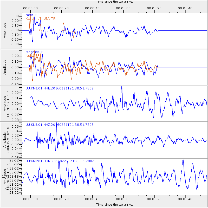
KNB Kanab, UT, USA - Earthquake Result Viewer
*The percent match for this event was below the threshold and hence no stack was calculated.
| Earthquake location: |
Volcano Islands, Japan Region |
| Earthquake latitude/longitude: |
24.6/142.4 |
| Earthquake time(UTC): |
2016/02/21 (052) 21:26:42 GMT |
| Earthquake Depth: |
21 km |
| Earthquake Magnitude: |
5.6 MB, 5.5 MWB, 5.7 MWW |
| Earthquake Catalog/Contributor: |
NEIC PDE/NEIC COMCAT |
|
| Network: |
UU University of Utah Regional Network |
| Station: |
KNB Kanab, UT, USA |
| Lat/Lon: |
37.02 N/112.82 W |
| Elevation: |
1715 m |
|
| Distance: |
86.5 deg |
| Az: |
50.845 deg |
| Baz: |
298.086 deg |
| Ray Param: |
$rayparam |
*The percent match for this event was below the threshold and hence was not used in the summary stack. |
|
| Radial Match: |
46.68625 % |
| Radial Bump: |
400 |
| Transverse Match: |
59.09944 % |
| Transverse Bump: |
400 |
| SOD ConfigId: |
1453031 |
| Insert Time: |
2016-03-28 23:48:41.989 +0000 |
| GWidth: |
2.5 |
| Max Bumps: |
400 |
| Tol: |
0.001 |
|
Signal To Noise
| Channel | StoN | STA | LTA |
| UU:KNB:01:HHZ:20160221T21:38:51.780Z | 2.0470226 | 1.1800086E-8 | 5.764512E-9 |
| UU:KNB:01:HHN:20160221T21:38:51.780Z | 0.9155958 | 4.3457713E-9 | 4.746386E-9 |
| UU:KNB:01:HHE:20160221T21:38:51.780Z | 0.918164 | 4.912035E-9 | 5.3498446E-9 |
| Arrivals |
| Ps | |
| PpPs | |
| PsPs/PpSs | |


