You are here: Home > Network List > TA - USArray Transportable Network (new EarthScope stations) Stations List
> Station F15A Butte, MT, USA > Earthquake Result Viewer
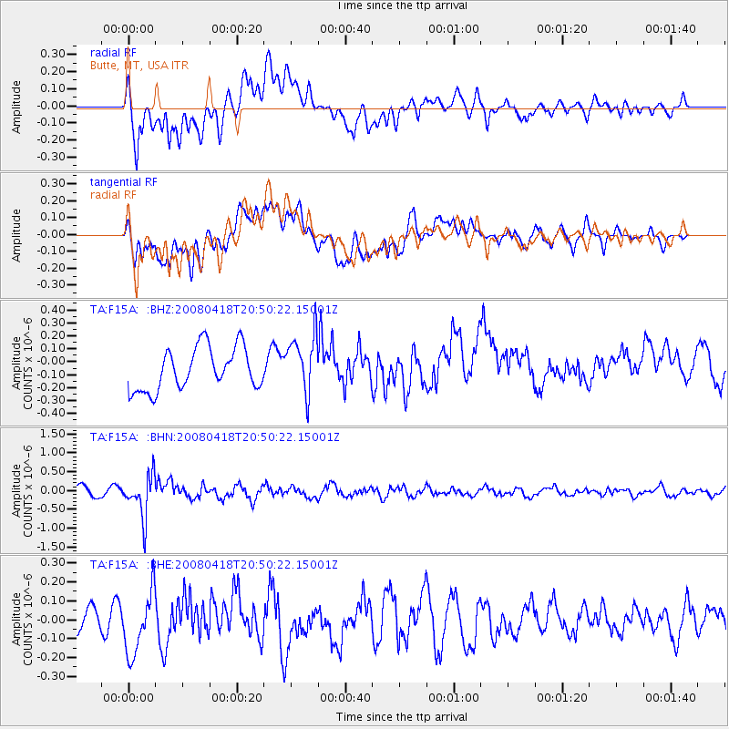
F15A Butte, MT, USA - Earthquake Result Viewer
*The percent match for this event was below the threshold and hence no stack was calculated.
| Earthquake location: |
Fiji Islands Region |
| Earthquake latitude/longitude: |
-17.3/-179.0 |
| Earthquake time(UTC): |
2008/04/18 (109) 20:39:07 GMT |
| Earthquake Depth: |
554 km |
| Earthquake Magnitude: |
5.9 MB, 6.3 MW, 6.3 MW |
| Earthquake Catalog/Contributor: |
WHDF/NEIC |
|
| Network: |
TA USArray Transportable Network (new EarthScope stations) |
| Station: |
F15A Butte, MT, USA |
| Lat/Lon: |
45.84 N/112.49 W |
| Elevation: |
1995 m |
|
| Distance: |
86.9 deg |
| Az: |
39.953 deg |
| Baz: |
241.327 deg |
| Ray Param: |
$rayparam |
*The percent match for this event was below the threshold and hence was not used in the summary stack. |
|
| Radial Match: |
58.749535 % |
| Radial Bump: |
400 |
| Transverse Match: |
54.691864 % |
| Transverse Bump: |
400 |
| SOD ConfigId: |
2504 |
| Insert Time: |
2010-03-06 04:59:55.282 +0000 |
| GWidth: |
2.5 |
| Max Bumps: |
400 |
| Tol: |
0.001 |
|
Signal To Noise
| Channel | StoN | STA | LTA |
| TA:F15A: :BHN:20080418T20:50:22.15001Z | 3.0394397 | 5.6066955E-7 | 1.8446477E-7 |
| TA:F15A: :BHE:20080418T20:50:22.15001Z | 2.1642997 | 1.6864045E-7 | 7.7919175E-8 |
| TA:F15A: :BHZ:20080418T20:50:22.15001Z | 1.3939677 | 2.2707587E-7 | 1.6289894E-7 |
| Arrivals |
| Ps | |
| PpPs | |
| PsPs/PpSs | |


