You are here: Home > Network List > G - GEOSCOPE Stations List
> Station MPG Montagne des Peres, French Guyana > Earthquake Result Viewer
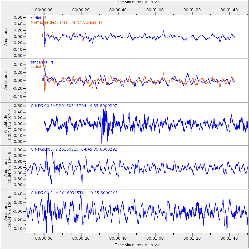
MPG Montagne des Peres, French Guyana - Earthquake Result Viewer
*The percent match for this event was below the threshold and hence no stack was calculated.
| Earthquake location: |
Strait Of Gibraltar |
| Earthquake latitude/longitude: |
35.8/-3.6 |
| Earthquake time(UTC): |
2016/03/15 (075) 04:40:40 GMT |
| Earthquake Depth: |
10 km |
| Earthquake Magnitude: |
5.6 MB |
| Earthquake Catalog/Contributor: |
NEIC PDE/NEIC COMCAT |
|
| Network: |
G GEOSCOPE |
| Station: |
MPG Montagne des Peres, French Guyana |
| Lat/Lon: |
5.11 N/52.64 W |
| Elevation: |
147 m |
|
| Distance: |
54.4 deg |
| Az: |
247.732 deg |
| Baz: |
49.083 deg |
| Ray Param: |
$rayparam |
*The percent match for this event was below the threshold and hence was not used in the summary stack. |
|
| Radial Match: |
57.9654 % |
| Radial Bump: |
400 |
| Transverse Match: |
65.42755 % |
| Transverse Bump: |
400 |
| SOD ConfigId: |
1453031 |
| Insert Time: |
2016-03-29 05:15:19.520 +0000 |
| GWidth: |
2.5 |
| Max Bumps: |
400 |
| Tol: |
0.001 |
|
Signal To Noise
| Channel | StoN | STA | LTA |
| G:MPG:00:BHZ:20160315T04:49:35.800029Z | 3.0601518 | 4.2754175E-7 | 1.397126E-7 |
| G:MPG:00:BHN:20160315T04:49:35.800029Z | 1.5573202 | 2.1096928E-7 | 1.3546942E-7 |
| G:MPG:00:BHE:20160315T04:49:35.800029Z | 2.5177953 | 2.9089108E-7 | 1.1553404E-7 |
| Arrivals |
| Ps | |
| PpPs | |
| PsPs/PpSs | |


