You are here: Home > Network List > TA - USArray Transportable Network (new EarthScope stations) Stations List
> Station D15A Lincoln, MT, USA > Earthquake Result Viewer
D15A Lincoln, MT, USA - Earthquake Result Viewer
| Earthquake location: |
Guatemala |
| Earthquake latitude/longitude: |
14.6/-91.2 |
| Earthquake time(UTC): |
2009/05/03 (123) 16:21:47 GMT |
| Earthquake Depth: |
124 km |
| Earthquake Magnitude: |
5.6 MB, 6.2 MW, 6.2 MW |
| Earthquake Catalog/Contributor: |
WHDF/NEIC |
|
| Network: |
TA USArray Transportable Network (new EarthScope stations) |
| Station: |
D15A Lincoln, MT, USA |
| Lat/Lon: |
47.04 N/112.52 W |
| Elevation: |
1593 m |
|
| Distance: |
37.0 deg |
| Az: |
335.53 deg |
| Baz: |
144.097 deg |
| Ray Param: |
0.07598278 |
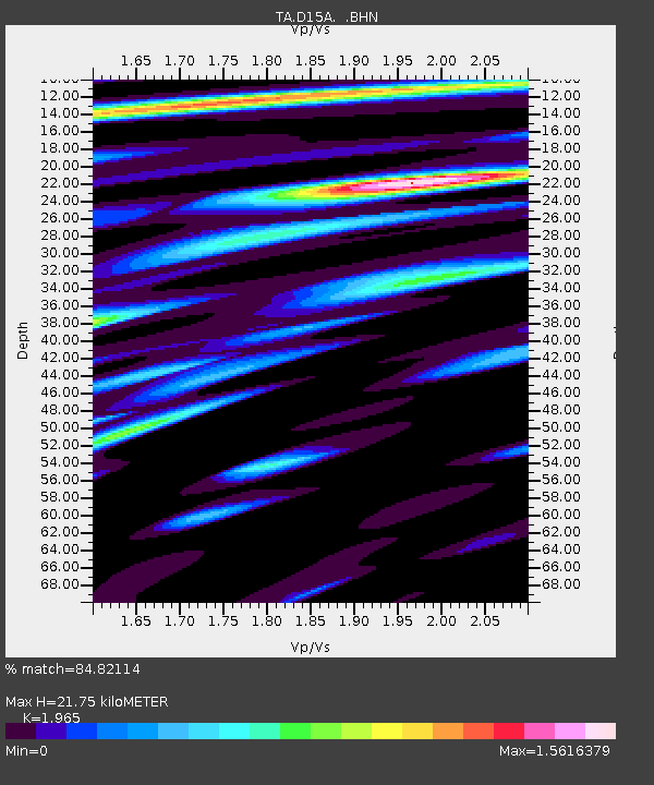
| Estimated Moho Depth: |
21.75 km |
| Estimated Crust Vp/Vs: |
1.97 |
| Assumed Crust Vp: |
6.353 km/s |
| Estimated Crust Vs: |
3.233 km/s |
| Estimated Crust Poisson's Ratio: |
0.33 |
|
| Radial Match: |
84.82114 % |
| Radial Bump: |
400 |
| Transverse Match: |
61.875366 % |
| Transverse Bump: |
400 |
| SOD ConfigId: |
2658 |
| Insert Time: |
2010-03-06 05:00:09.345 +0000 |
| GWidth: |
2.5 |
| Max Bumps: |
400 |
| Tol: |
0.001 |
|
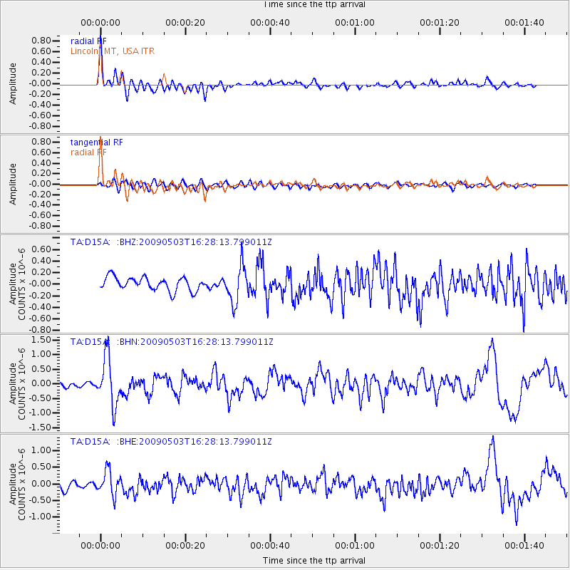
Signal To Noise
| Channel | StoN | STA | LTA |
| TA:D15A: :BHN:20090503T16:28:13.799011Z | 7.909015 | 8.3047775E-7 | 1.0500394E-7 |
| TA:D15A: :BHE:20090503T16:28:13.799011Z | 3.5585682 | 3.6622225E-7 | 1.02912814E-7 |
| TA:D15A: :BHZ:20090503T16:28:13.799011Z | 2.7869794 | 3.177511E-7 | 1.14012714E-7 |
| Arrivals |
| Ps | 3.5 SECOND |
| PpPs | 9.5 SECOND |
| PsPs/PpSs | 13 SECOND |


