
D15A Lincoln, MT, USA - Earthquake Result Viewer
| ||||||||||||||||||
| ||||||||||||||||||
| ||||||||||||||||||
|
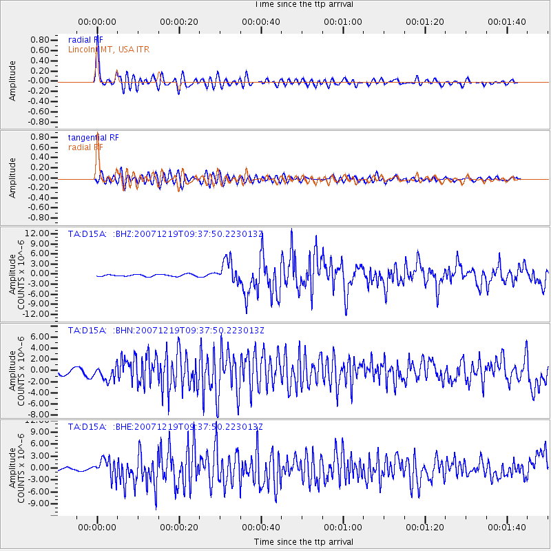
Signal To Noise
| Channel | StoN | STA | LTA |
| TA:D15A: :BHN:20071219T09:37:50.223013Z | 1.6307122 | 1.2641931E-6 | 7.752399E-7 |
| TA:D15A: :BHE:20071219T09:37:50.223013Z | 8.908793 | 2.360639E-6 | 2.6497852E-7 |
| TA:D15A: :BHZ:20071219T09:37:50.223013Z | 11.142619 | 3.3805863E-6 | 3.0339245E-7 |
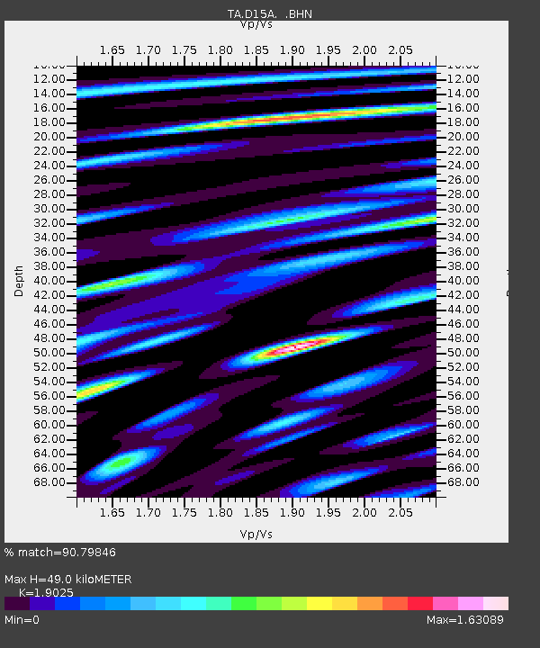
| Arrivals | |
| Ps | 7.4 SECOND |
| PpPs | 21 SECOND |
| PsPs/PpSs | 28 SECOND |

