
D15A Lincoln, MT, USA - Earthquake Result Viewer
| ||||||||||||||||||
| ||||||||||||||||||
| ||||||||||||||||||
|
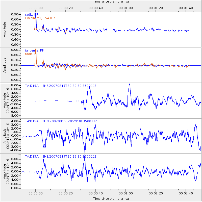
Signal To Noise
| Channel | StoN | STA | LTA |
| TA:D15A: :BHN:20070815T20:29:30.350011Z | 5.2973814 | 9.3992605E-7 | 1.774322E-7 |
| TA:D15A: :BHE:20070815T20:29:30.350011Z | 17.15588 | 1.4745209E-6 | 8.594843E-8 |
| TA:D15A: :BHZ:20070815T20:29:30.350011Z | 25.493288 | 2.6761402E-6 | 1.04974305E-7 |
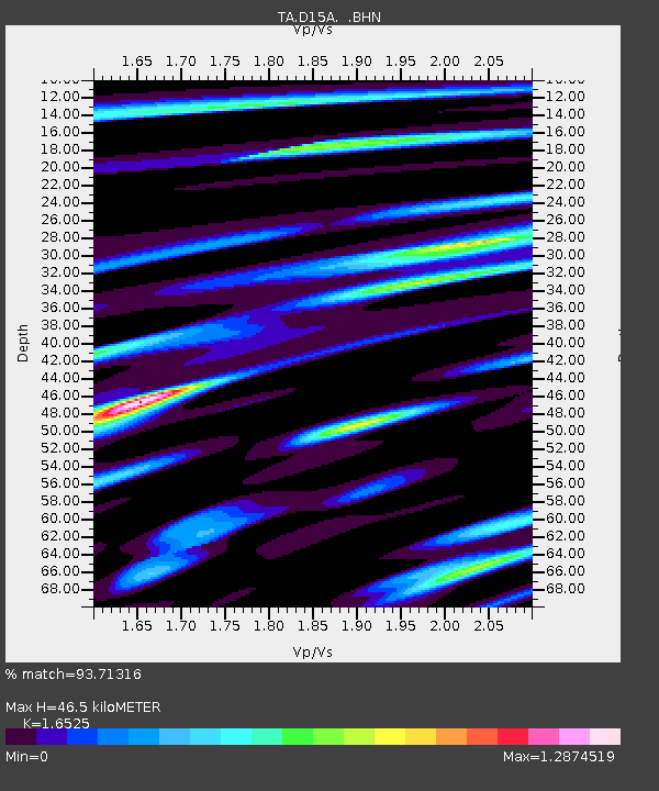
| Arrivals | |
| Ps | 5.1 SECOND |
| PpPs | 18 SECOND |
| PsPs/PpSs | 23 SECOND |

