
D15A Lincoln, MT, USA - Earthquake Result Viewer
| ||||||||||||||||||
| ||||||||||||||||||
| ||||||||||||||||||
|
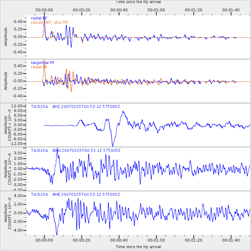
Signal To Noise
| Channel | StoN | STA | LTA |
| TA:D15A: :BHN:20070325T00:53:12.575005Z | 8.434422 | 1.2276885E-6 | 1.4555692E-7 |
| TA:D15A: :BHE:20070325T00:53:12.575005Z | 2.31704 | 9.3535783E-7 | 4.0368653E-7 |
| TA:D15A: :BHZ:20070325T00:53:12.575005Z | 3.4113467 | 3.0414938E-6 | 8.915816E-7 |
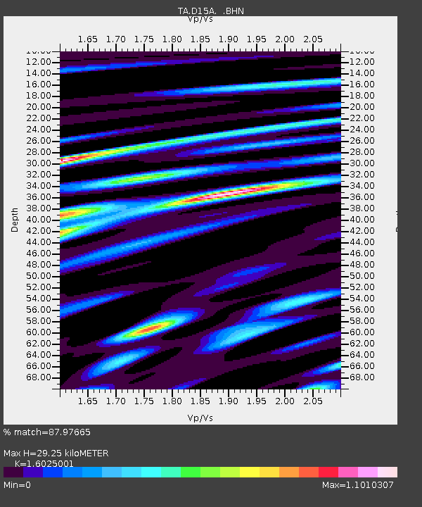
| Arrivals | |
| Ps | 2.9 SECOND |
| PpPs | 12 SECOND |
| PsPs/PpSs | 14 SECOND |

