You are here: Home > Network List > TA - USArray Transportable Network (new EarthScope stations) Stations List
> Station 121A Cookes Peak, Deming, NM, USA > Earthquake Result Viewer
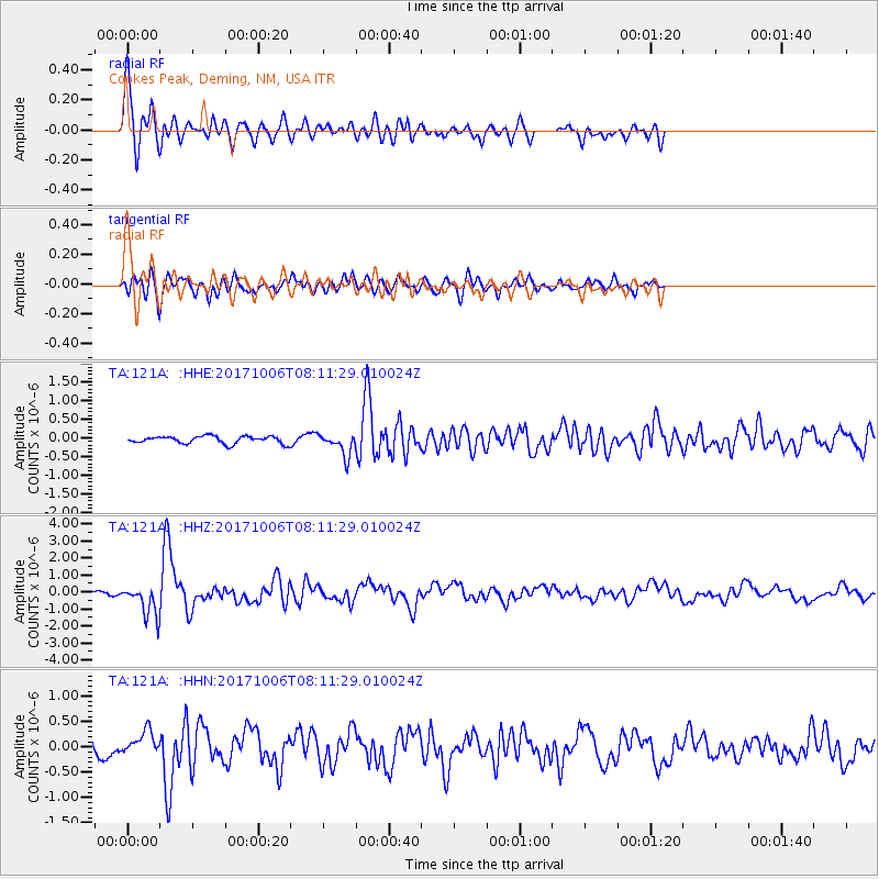
121A Cookes Peak, Deming, NM, USA - Earthquake Result Viewer
*The percent match for this event was below the threshold and hence no stack was calculated.
| Earthquake location: |
Off East Coast Of Honshu, Japan |
| Earthquake latitude/longitude: |
37.5/144.0 |
| Earthquake time(UTC): |
2017/10/06 (279) 07:59:33 GMT |
| Earthquake Depth: |
10 km |
| Earthquake Magnitude: |
6.0 Mww |
| Earthquake Catalog/Contributor: |
NEIC PDE/us |
|
| Network: |
TA USArray Transportable Network (new EarthScope stations) |
| Station: |
121A Cookes Peak, Deming, NM, USA |
| Lat/Lon: |
32.53 N/107.79 W |
| Elevation: |
1652 m |
|
| Distance: |
83.5 deg |
| Az: |
53.845 deg |
| Baz: |
310.504 deg |
| Ray Param: |
$rayparam |
*The percent match for this event was below the threshold and hence was not used in the summary stack. |
|
| Radial Match: |
77.54881 % |
| Radial Bump: |
400 |
| Transverse Match: |
71.38648 % |
| Transverse Bump: |
400 |
| SOD ConfigId: |
13570011 |
| Insert Time: |
2019-04-28 22:41:56.701 +0000 |
| GWidth: |
2.5 |
| Max Bumps: |
400 |
| Tol: |
0.001 |
|
Signal To Noise
| Channel | StoN | STA | LTA |
| TA:121A: :HHZ:20171006T08:11:29.010024Z | 9.186112 | 9.675671E-7 | 1.0532934E-7 |
| TA:121A: :HHN:20171006T08:11:29.010024Z | 1.4951038 | 2.1990628E-7 | 1.470843E-7 |
| TA:121A: :HHE:20171006T08:11:29.010024Z | 3.1595135 | 3.1821028E-7 | 1.0071496E-7 |
| Arrivals |
| Ps | |
| PpPs | |
| PsPs/PpSs | |


