You are here: Home > Network List > TA - USArray Transportable Network (new EarthScope stations) Stations List
> Station A21K Barrow, AK, USA > Earthquake Result Viewer
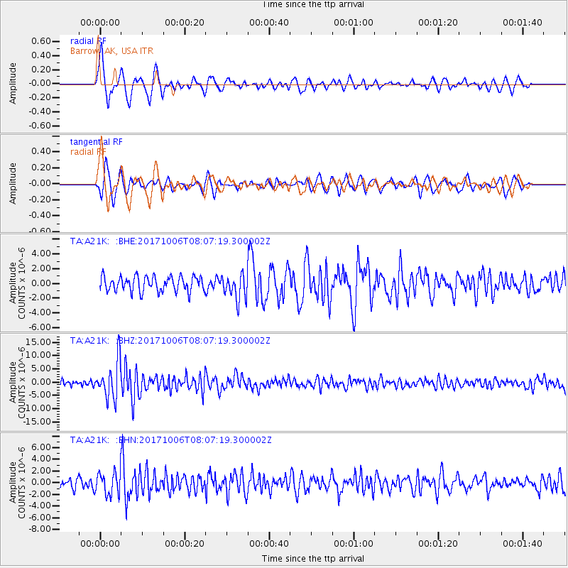
A21K Barrow, AK, USA - Earthquake Result Viewer
*The percent match for this event was below the threshold and hence no stack was calculated.
| Earthquake location: |
Off East Coast Of Honshu, Japan |
| Earthquake latitude/longitude: |
37.5/144.0 |
| Earthquake time(UTC): |
2017/10/06 (279) 07:59:33 GMT |
| Earthquake Depth: |
10 km |
| Earthquake Magnitude: |
6.0 Mww |
| Earthquake Catalog/Contributor: |
NEIC PDE/us |
|
| Network: |
TA USArray Transportable Network (new EarthScope stations) |
| Station: |
A21K Barrow, AK, USA |
| Lat/Lon: |
71.32 N/156.62 W |
| Elevation: |
577 m |
|
| Distance: |
45.2 deg |
| Az: |
22.992 deg |
| Baz: |
254.668 deg |
| Ray Param: |
$rayparam |
*The percent match for this event was below the threshold and hence was not used in the summary stack. |
|
| Radial Match: |
79.51755 % |
| Radial Bump: |
400 |
| Transverse Match: |
71.97859 % |
| Transverse Bump: |
400 |
| SOD ConfigId: |
13570011 |
| Insert Time: |
2019-04-28 22:41:59.719 +0000 |
| GWidth: |
2.5 |
| Max Bumps: |
400 |
| Tol: |
0.001 |
|
Signal To Noise
| Channel | StoN | STA | LTA |
| TA:A21K: :BHZ:20171006T08:07:19.300002Z | 5.6180973 | 7.177373E-6 | 1.2775452E-6 |
| TA:A21K: :BHN:20171006T08:07:19.300002Z | 2.3938253 | 1.8839519E-6 | 7.870048E-7 |
| TA:A21K: :BHE:20171006T08:07:19.300002Z | 1.9846263 | 2.0028313E-6 | 1.009173E-6 |
| Arrivals |
| Ps | |
| PpPs | |
| PsPs/PpSs | |


