You are here: Home > Network List > TA - USArray Transportable Network (new EarthScope stations) Stations List
> Station H16K Elim, AK, USA > Earthquake Result Viewer
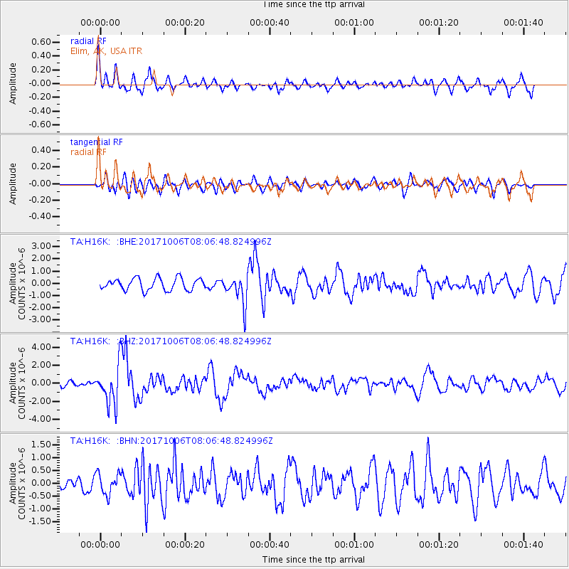
H16K Elim, AK, USA - Earthquake Result Viewer
*The percent match for this event was below the threshold and hence no stack was calculated.
| Earthquake location: |
Off East Coast Of Honshu, Japan |
| Earthquake latitude/longitude: |
37.5/144.0 |
| Earthquake time(UTC): |
2017/10/06 (279) 07:59:33 GMT |
| Earthquake Depth: |
10 km |
| Earthquake Magnitude: |
6.0 Mww |
| Earthquake Catalog/Contributor: |
NEIC PDE/us |
|
| Network: |
TA USArray Transportable Network (new EarthScope stations) |
| Station: |
H16K Elim, AK, USA |
| Lat/Lon: |
64.64 N/162.24 W |
| Elevation: |
216 m |
|
| Distance: |
41.5 deg |
| Az: |
31.654 deg |
| Baz: |
255.758 deg |
| Ray Param: |
$rayparam |
*The percent match for this event was below the threshold and hence was not used in the summary stack. |
|
| Radial Match: |
68.57452 % |
| Radial Bump: |
400 |
| Transverse Match: |
55.497665 % |
| Transverse Bump: |
400 |
| SOD ConfigId: |
13570011 |
| Insert Time: |
2019-04-28 22:42:49.441 +0000 |
| GWidth: |
2.5 |
| Max Bumps: |
400 |
| Tol: |
0.001 |
|
Signal To Noise
| Channel | StoN | STA | LTA |
| TA:H16K: :BHZ:20171006T08:06:48.824996Z | 4.091172 | 2.216457E-6 | 5.4176576E-7 |
| TA:H16K: :BHN:20171006T08:06:48.824996Z | 0.88014746 | 4.1263633E-7 | 4.6882636E-7 |
| TA:H16K: :BHE:20171006T08:06:48.824996Z | 2.6392748 | 1.2826131E-6 | 4.859718E-7 |
| Arrivals |
| Ps | |
| PpPs | |
| PsPs/PpSs | |


