D15A Lincoln, MT, USA - Earthquake Result Viewer
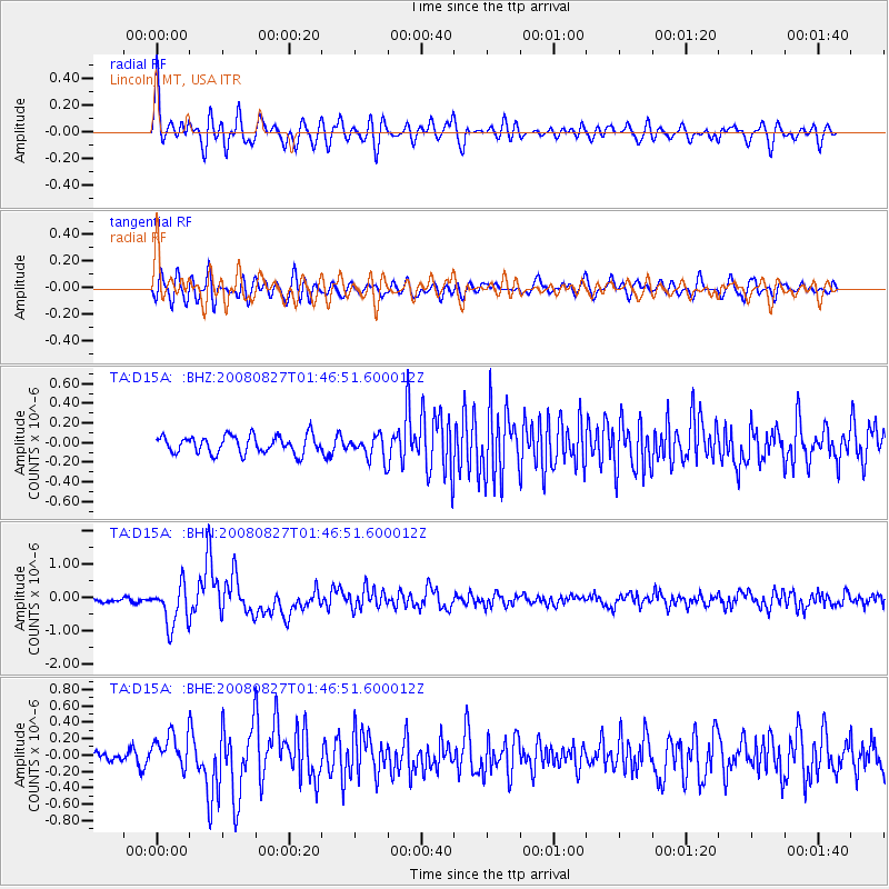
Earthquake location: Lake Baykal Region, Russia
Earthquake latitude/longitude: 51.6/104.2
Earthquake time(UTC): 2008/08/27 (240) 01:35:32 GMT
Earthquake Depth: 16 km
Earthquake Magnitude: 5.8 MB, 6.2 MS, 6.2 MW, 6.2 MW
Earthquake Catalog/Contributor: WHDF/NEIC
Network: TA USArray Transportable Network (new EarthScope stations)
Station: D15A Lincoln, MT, USA
Lat/Lon: 47.04 N/112.52 W
Elevation: 1593 m
Distance: 76.8 deg
Az: 24.809 deg
Baz: 337.505 deg
Ray Param: 0.05073678
Estimated Moho Depth: 56.5 km
Estimated Crust Vp/Vs: 1.90
Assumed Crust Vp: 6.353 km/s
Estimated Crust Vs: 3.344 km/s
Estimated Crust Poisson's Ratio: 0.31
Radial Match: 81.837036 %
Radial Bump: 400
Transverse Match: 72.47446 %
Transverse Bump: 400
SOD ConfigId: 2504
Insert Time: 2010-03-06 05:01:51.750 +0000
GWidth: 2.5
Max Bumps: 400
Tol: 0.001

Signal To Noise

ChannelStoNSTALTA
TA:D15A: :BHN:20080827T01:46:51.600012Z7.16742666.142529E-78.570062E-8
TA:D15A: :BHE:20080827T01:46:51.600012Z3.58559252.0835058E-75.8107712E-8
TA:D15A: :BHZ:20080827T01:46:51.600012Z1.3337971.1939869E-78.951789E-8
Arrivals
Ps8.2 SECOND
PpPs25 SECOND
PsPs/PpSs33 SECOND