
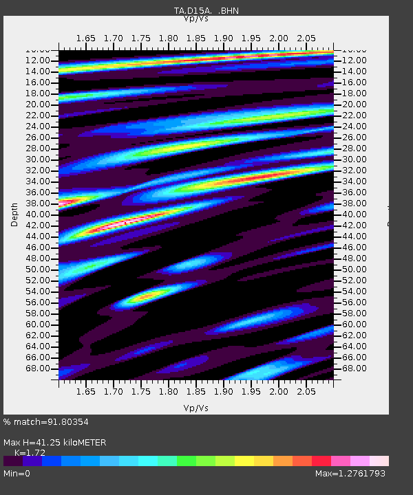
D15A Lincoln, MT, USA - Earthquake Result Viewer
| ||||||||||||||||||
| ||||||||||||||||||
| ||||||||||||||||||
|
Signal To Noise
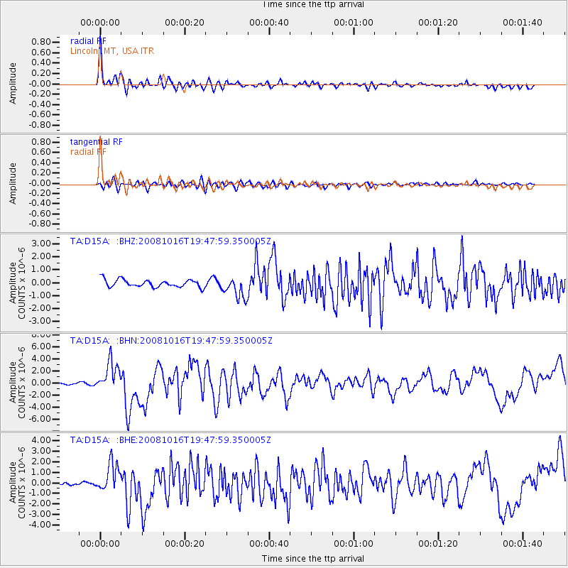
| Channel | StoN | STA | LTA |
| TA:D15A: :BHN:20081016T19:47:59.350005Z | 19.143997 | 2.5217778E-6 | 1.3172681E-7 |
| TA:D15A: :BHE:20081016T19:47:59.350005Z | 13.474725 | 1.3948805E-6 | 1.03518296E-7 |
| TA:D15A: :BHZ:20081016T19:47:59.350005Z | 2.9777243 | 8.614822E-7 | 2.8930893E-7 |
| Arrivals | |
| Ps | 5.0 SECOND |
| PpPs | 16 SECOND |
| PsPs/PpSs | 21 SECOND |

