You are here: Home > Network List > TA - USArray Transportable Network (new EarthScope stations) Stations List
> Station R18K Karluk, AK, USA > Earthquake Result Viewer
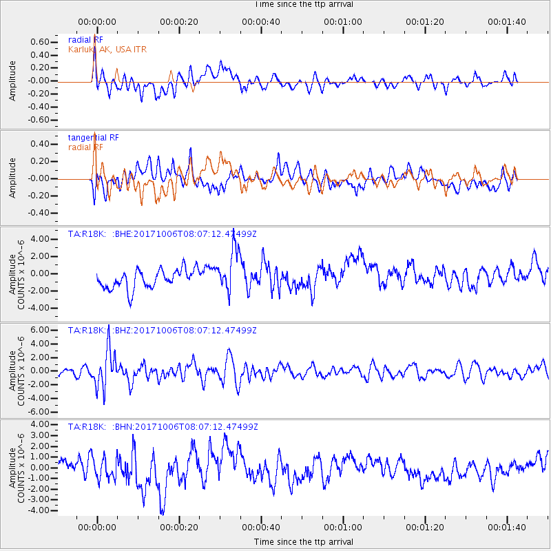
R18K Karluk, AK, USA - Earthquake Result Viewer
*The percent match for this event was below the threshold and hence no stack was calculated.
| Earthquake location: |
Off East Coast Of Honshu, Japan |
| Earthquake latitude/longitude: |
37.5/144.0 |
| Earthquake time(UTC): |
2017/10/06 (279) 07:59:33 GMT |
| Earthquake Depth: |
10 km |
| Earthquake Magnitude: |
6.0 Mww |
| Earthquake Catalog/Contributor: |
NEIC PDE/us |
|
| Network: |
TA USArray Transportable Network (new EarthScope stations) |
| Station: |
R18K Karluk, AK, USA |
| Lat/Lon: |
57.57 N/154.45 W |
| Elevation: |
39 m |
|
| Distance: |
44.4 deg |
| Az: |
42.64 deg |
| Baz: |
270.637 deg |
| Ray Param: |
$rayparam |
*The percent match for this event was below the threshold and hence was not used in the summary stack. |
|
| Radial Match: |
42.98965 % |
| Radial Bump: |
400 |
| Transverse Match: |
42.314846 % |
| Transverse Bump: |
400 |
| SOD ConfigId: |
13570011 |
| Insert Time: |
2019-04-28 22:44:12.788 +0000 |
| GWidth: |
2.5 |
| Max Bumps: |
400 |
| Tol: |
0.001 |
|
Signal To Noise
| Channel | StoN | STA | LTA |
| TA:R18K: :BHZ:20171006T08:07:12.47499Z | 4.1539645 | 2.8258473E-6 | 6.802772E-7 |
| TA:R18K: :BHN:20171006T08:07:12.47499Z | 1.4024173 | 9.3038034E-7 | 6.634119E-7 |
| TA:R18K: :BHE:20171006T08:07:12.47499Z | 2.3859837 | 2.6237403E-6 | 1.0996472E-6 |
| Arrivals |
| Ps | |
| PpPs | |
| PsPs/PpSs | |


