D15A Lincoln, MT, USA - Earthquake Result Viewer
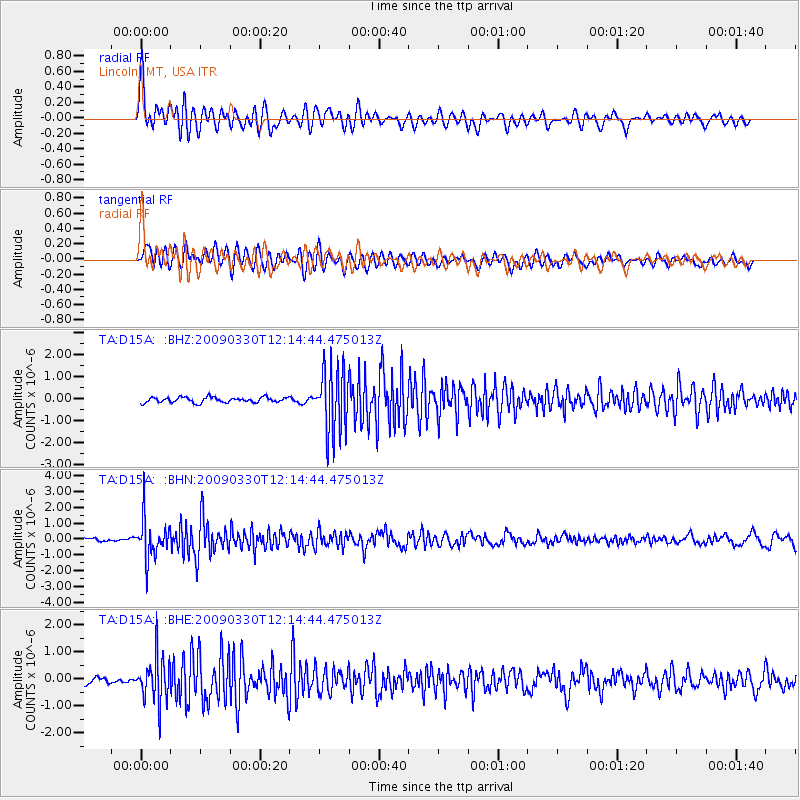
Earthquake location: Andreanof Islands, Aleutian Is.
Earthquake latitude/longitude: 51.5/-178.3
Earthquake time(UTC): 2009/03/30 (089) 12:07:28 GMT
Earthquake Depth: 31 km
Earthquake Magnitude: 6.0 MB, 5.5 MS, 5.7 MW, 5.7 MW
Earthquake Catalog/Contributor: WHDF/NEIC
Network: TA USArray Transportable Network (new EarthScope stations)
Station: D15A Lincoln, MT, USA
Lat/Lon: 47.04 N/112.52 W
Elevation: 1593 m
Distance: 41.8 deg
Az: 69.251 deg
Baz: 301.347 deg
Ray Param: 0.07348977
Estimated Moho Depth: 17.0 km
Estimated Crust Vp/Vs: 1.89
Assumed Crust Vp: 6.353 km/s
Estimated Crust Vs: 3.357 km/s
Estimated Crust Poisson's Ratio: 0.31
Radial Match: 82.62858 %
Radial Bump: 400
Transverse Match: 73.353745 %
Transverse Bump: 400
SOD ConfigId: 2658
Insert Time: 2010-03-06 05:02:47.666 +0000
GWidth: 2.5
Max Bumps: 400
Tol: 0.001

Signal To Noise

ChannelStoNSTALTA
TA:D15A: :BHN:20090330T12:14:44.475013Z11.2593861.2419333E-61.1030205E-7
TA:D15A: :BHE:20090330T12:14:44.475013Z6.24110948.245747E-71.3211991E-7
TA:D15A: :BHZ:20090330T12:14:44.475013Z12.28811.4471666E-61.1776976E-7
Arrivals
Ps2.5 SECOND
PpPs7.3 SECOND
PsPs/PpSs9.8 SECOND