You are here: Home > Network List > CI - Caltech Regional Seismic Network Stations List
> Station SMM Simmler, CA, USA > Earthquake Result Viewer
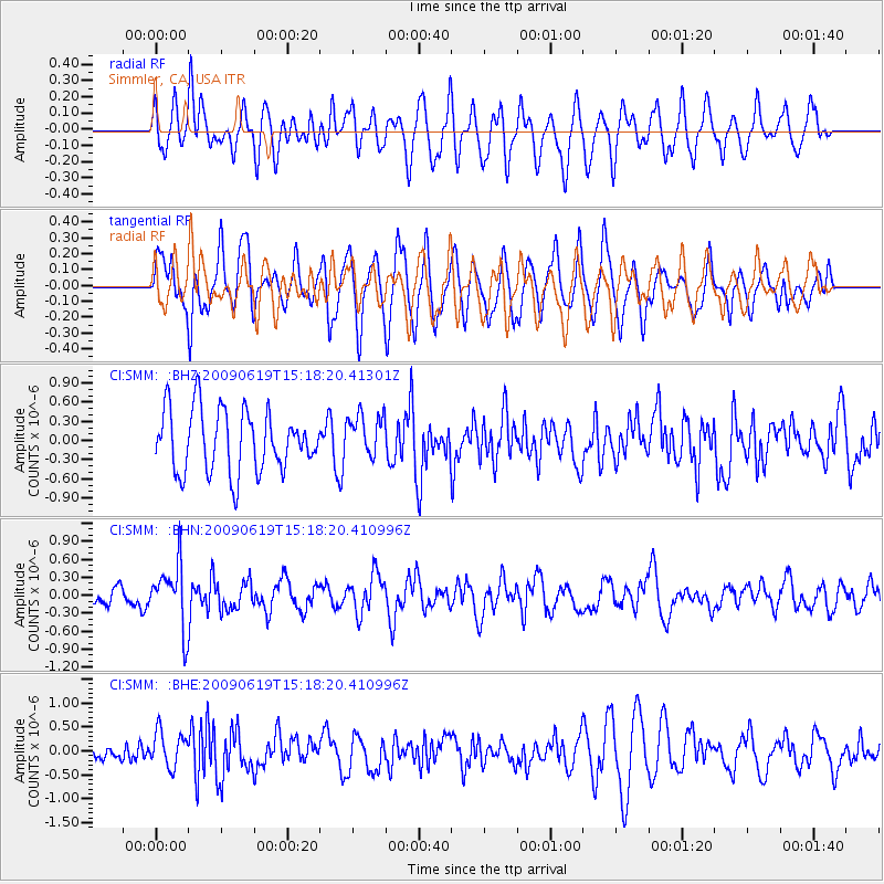
SMM Simmler, CA, USA - Earthquake Result Viewer
*The percent match for this event was below the threshold and hence no stack was calculated.
| Earthquake location: |
Mariana Islands |
| Earthquake latitude/longitude: |
14.1/145.2 |
| Earthquake time(UTC): |
2009/06/19 (170) 15:06:24 GMT |
| Earthquake Depth: |
114 km |
| Earthquake Magnitude: |
5.5 MB, 5.5 MW |
| Earthquake Catalog/Contributor: |
WHDF/NEIC |
|
| Network: |
CI Caltech Regional Seismic Network |
| Station: |
SMM Simmler, CA, USA |
| Lat/Lon: |
35.31 N/120.00 W |
| Elevation: |
599 m |
|
| Distance: |
85.8 deg |
| Az: |
54.794 deg |
| Baz: |
284.191 deg |
| Ray Param: |
$rayparam |
*The percent match for this event was below the threshold and hence was not used in the summary stack. |
|
| Radial Match: |
47.9696 % |
| Radial Bump: |
400 |
| Transverse Match: |
61.086037 % |
| Transverse Bump: |
400 |
| SOD ConfigId: |
2648 |
| Insert Time: |
2010-02-26 01:31:18.844 +0000 |
| GWidth: |
2.5 |
| Max Bumps: |
400 |
| Tol: |
0.001 |
|
Signal To Noise
| Channel | StoN | STA | LTA |
| CI:SMM: :BHN:20090619T15:18:20.410996Z | 2.5104802 | 5.236088E-7 | 2.0856918E-7 |
| CI:SMM: :BHE:20090619T15:18:20.410996Z | 1.5133114 | 3.7883208E-7 | 2.5033322E-7 |
| CI:SMM: :BHZ:20090619T15:18:20.41301Z | 0.71266353 | 3.4354116E-7 | 4.8205237E-7 |
| Arrivals |
| Ps | |
| PpPs | |
| PsPs/PpSs | |


