You are here: Home > Network List > TA - USArray Transportable Network (new EarthScope stations) Stations List
> Station D15A Lincoln, MT, USA > Earthquake Result Viewer
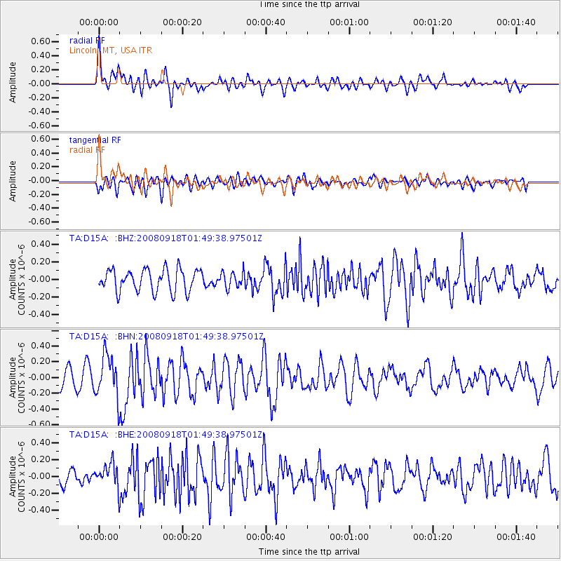
D15A Lincoln, MT, USA - Earthquake Result Viewer
*The percent match for this event was below the threshold and hence no stack was calculated.
| Earthquake location: |
Central East Pacific Rise |
| Earthquake latitude/longitude: |
-4.6/-106.0 |
| Earthquake time(UTC): |
2008/09/18 (262) 01:41:02 GMT |
| Earthquake Depth: |
10 km |
| Earthquake Magnitude: |
5.5 MB, 5.7 MS, 6.0 MW, 6.0 MW |
| Earthquake Catalog/Contributor: |
WHDF/NEIC |
|
| Network: |
TA USArray Transportable Network (new EarthScope stations) |
| Station: |
D15A Lincoln, MT, USA |
| Lat/Lon: |
47.04 N/112.52 W |
| Elevation: |
1593 m |
|
| Distance: |
51.7 deg |
| Az: |
354.32 deg |
| Baz: |
171.706 deg |
| Ray Param: |
$rayparam |
*The percent match for this event was below the threshold and hence was not used in the summary stack. |
|
| Radial Match: |
74.43708 % |
| Radial Bump: |
400 |
| Transverse Match: |
51.236073 % |
| Transverse Bump: |
400 |
| SOD ConfigId: |
2560 |
| Insert Time: |
2010-03-06 05:03:33.199 +0000 |
| GWidth: |
2.5 |
| Max Bumps: |
400 |
| Tol: |
0.001 |
|
Signal To Noise
| Channel | StoN | STA | LTA |
| TA:D15A: :BHN:20080918T01:49:38.97501Z | 1.9760522 | 2.734319E-7 | 1.3837281E-7 |
| TA:D15A: :BHE:20080918T01:49:38.97501Z | 1.7202673 | 1.4207222E-7 | 8.258729E-8 |
| TA:D15A: :BHZ:20080918T01:49:38.97501Z | 0.7176907 | 9.0278974E-8 | 1.2579092E-7 |
| Arrivals |
| Ps | |
| PpPs | |
| PsPs/PpSs | |


