You are here: Home > Network List > CN - Canadian National Seismograph Network Stations List
> Station INK INUVIK, NT > Earthquake Result Viewer
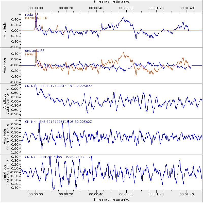
INK INUVIK, NT - Earthquake Result Viewer
*The percent match for this event was below the threshold and hence no stack was calculated.
| Earthquake location: |
Near East Coast Of Honshu, Japan |
| Earthquake latitude/longitude: |
37.1/141.2 |
| Earthquake time(UTC): |
2017/10/06 (279) 14:56:40 GMT |
| Earthquake Depth: |
47 km |
| Earthquake Magnitude: |
5.4 Mww |
| Earthquake Catalog/Contributor: |
NEIC PDE/us |
|
| Network: |
CN Canadian National Seismograph Network |
| Station: |
INK INUVIK, NT |
| Lat/Lon: |
68.31 N/133.53 W |
| Elevation: |
44 m |
|
| Distance: |
54.4 deg |
| Az: |
27.108 deg |
| Baz: |
281.506 deg |
| Ray Param: |
$rayparam |
*The percent match for this event was below the threshold and hence was not used in the summary stack. |
|
| Radial Match: |
36.53202 % |
| Radial Bump: |
400 |
| Transverse Match: |
49.526554 % |
| Transverse Bump: |
400 |
| SOD ConfigId: |
13570011 |
| Insert Time: |
2019-04-28 22:49:00.001 +0000 |
| GWidth: |
2.5 |
| Max Bumps: |
400 |
| Tol: |
0.001 |
|
Signal To Noise
| Channel | StoN | STA | LTA |
| CN:INK: :BHZ:20171006T15:05:32.22502Z | 2.557652 | 4.6755204E-7 | 1.8280518E-7 |
| CN:INK: :BHN:20171006T15:05:32.22502Z | 1.0819398 | 1.43801E-7 | 1.3291036E-7 |
| CN:INK: :BHE:20171006T15:05:32.22502Z | 1.6655886 | 5.364192E-7 | 3.2205983E-7 |
| Arrivals |
| Ps | |
| PpPs | |
| PsPs/PpSs | |


