You are here: Home > Network List > CI - Caltech Regional Seismic Network Stations List
> Station SMM Simmler, CA, USA > Earthquake Result Viewer
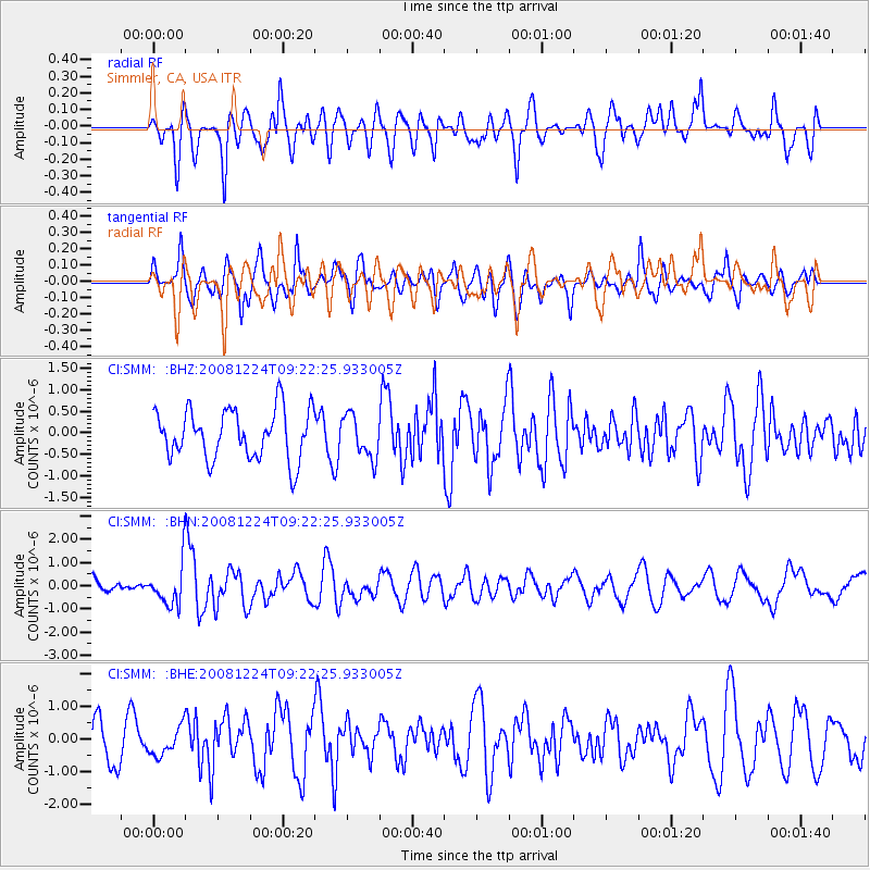
SMM Simmler, CA, USA - Earthquake Result Viewer
*The percent match for this event was below the threshold and hence no stack was calculated.
| Earthquake location: |
Tonga Islands Region |
| Earthquake latitude/longitude: |
-17.3/-171.9 |
| Earthquake time(UTC): |
2008/12/24 (359) 09:11:34 GMT |
| Earthquake Depth: |
9.0 km |
| Earthquake Magnitude: |
5.9 MB, 5.6 MS, 6.0 MW, 6.0 MW |
| Earthquake Catalog/Contributor: |
WHDF/NEIC |
|
| Network: |
CI Caltech Regional Seismic Network |
| Station: |
SMM Simmler, CA, USA |
| Lat/Lon: |
35.31 N/120.00 W |
| Elevation: |
599 m |
|
| Distance: |
71.8 deg |
| Az: |
42.649 deg |
| Baz: |
232.322 deg |
| Ray Param: |
$rayparam |
*The percent match for this event was below the threshold and hence was not used in the summary stack. |
|
| Radial Match: |
60.08592 % |
| Radial Bump: |
400 |
| Transverse Match: |
62.767876 % |
| Transverse Bump: |
400 |
| SOD ConfigId: |
2658 |
| Insert Time: |
2010-02-26 01:31:21.651 +0000 |
| GWidth: |
2.5 |
| Max Bumps: |
400 |
| Tol: |
0.001 |
|
Signal To Noise
| Channel | StoN | STA | LTA |
| CI:SMM: :BHN:20081224T09:22:25.933005Z | 2.1057703 | 8.8969415E-7 | 4.2250292E-7 |
| CI:SMM: :BHE:20081224T09:22:25.933005Z | 0.91239035 | 4.2878978E-7 | 4.6996306E-7 |
| CI:SMM: :BHZ:20081224T09:22:25.933005Z | 0.85638314 | 4.919974E-7 | 5.7450615E-7 |
| Arrivals |
| Ps | |
| PpPs | |
| PsPs/PpSs | |


