You are here: Home > Network List > TA - USArray Transportable Network (new EarthScope stations) Stations List
> Station D15A Lincoln, MT, USA > Earthquake Result Viewer
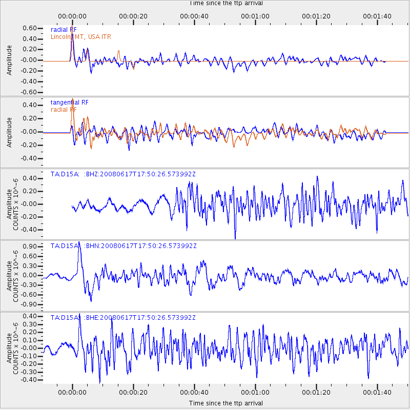
D15A Lincoln, MT, USA - Earthquake Result Viewer
*The percent match for this event was below the threshold and hence no stack was calculated.
| Earthquake location: |
South Of Panama |
| Earthquake latitude/longitude: |
5.0/-82.7 |
| Earthquake time(UTC): |
2008/06/17 (169) 17:42:09 GMT |
| Earthquake Depth: |
10 km |
| Earthquake Magnitude: |
5.6 MB, 5.3 MS, 5.9 MW, 5.9 MW |
| Earthquake Catalog/Contributor: |
WHDF/NEIC |
|
| Network: |
TA USArray Transportable Network (new EarthScope stations) |
| Station: |
D15A Lincoln, MT, USA |
| Lat/Lon: |
47.04 N/112.52 W |
| Elevation: |
1593 m |
|
| Distance: |
49.1 deg |
| Az: |
333.238 deg |
| Baz: |
139.012 deg |
| Ray Param: |
$rayparam |
*The percent match for this event was below the threshold and hence was not used in the summary stack. |
|
| Radial Match: |
70.62229 % |
| Radial Bump: |
400 |
| Transverse Match: |
70.00365 % |
| Transverse Bump: |
400 |
| SOD ConfigId: |
2504 |
| Insert Time: |
2010-03-06 05:03:59.590 +0000 |
| GWidth: |
2.5 |
| Max Bumps: |
400 |
| Tol: |
0.001 |
|
Signal To Noise
| Channel | StoN | STA | LTA |
| TA:D15A: :BHN:20080617T17:50:26.573992Z | 7.057891 | 4.3283518E-7 | 6.132642E-8 |
| TA:D15A: :BHE:20080617T17:50:26.573992Z | 3.1676435 | 1.565816E-7 | 4.9431577E-8 |
| TA:D15A: :BHZ:20080617T17:50:26.573992Z | 2.4550853 | 1.3595162E-7 | 5.5375523E-8 |
| Arrivals |
| Ps | |
| PpPs | |
| PsPs/PpSs | |


