You are here: Home > Network List > TA - USArray Transportable Network (new EarthScope stations) Stations List
> Station D15A Lincoln, MT, USA > Earthquake Result Viewer
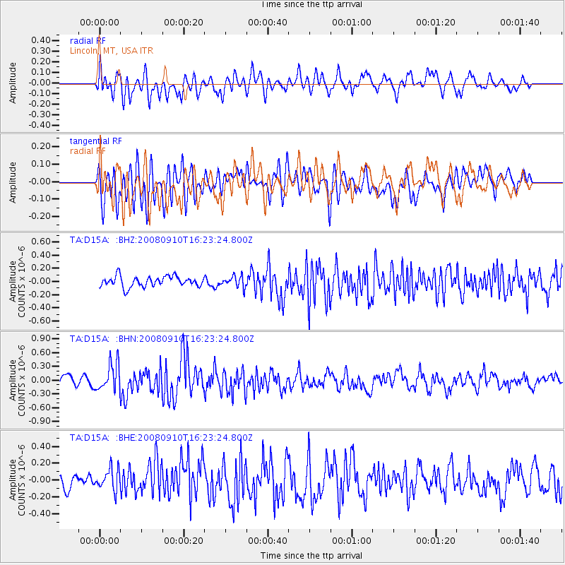
D15A Lincoln, MT, USA - Earthquake Result Viewer
*The percent match for this event was below the threshold and hence no stack was calculated.
| Earthquake location: |
Northern Chile |
| Earthquake latitude/longitude: |
-20.3/-69.2 |
| Earthquake time(UTC): |
2008/09/10 (254) 16:12:04 GMT |
| Earthquake Depth: |
38 km |
| Earthquake Magnitude: |
5.6 MB, 5.3 MS |
| Earthquake Catalog/Contributor: |
WHDF/NEIC |
|
| Network: |
TA USArray Transportable Network (new EarthScope stations) |
| Station: |
D15A Lincoln, MT, USA |
| Lat/Lon: |
47.04 N/112.52 W |
| Elevation: |
1593 m |
|
| Distance: |
77.5 deg |
| Az: |
331.291 deg |
| Baz: |
138.743 deg |
| Ray Param: |
$rayparam |
*The percent match for this event was below the threshold and hence was not used in the summary stack. |
|
| Radial Match: |
64.23871 % |
| Radial Bump: |
400 |
| Transverse Match: |
64.91925 % |
| Transverse Bump: |
400 |
| SOD ConfigId: |
2560 |
| Insert Time: |
2010-03-06 05:04:24.558 +0000 |
| GWidth: |
2.5 |
| Max Bumps: |
400 |
| Tol: |
0.001 |
|
Signal To Noise
| Channel | StoN | STA | LTA |
| TA:D15A: :BHN:20080910T16:23:24.800Z | 2.5650136 | 3.022675E-7 | 1.17842454E-7 |
| TA:D15A: :BHE:20080910T16:23:24.800Z | 1.0080079 | 1.3428142E-7 | 1.3321464E-7 |
| TA:D15A: :BHZ:20080910T16:23:24.800Z | 1.050184 | 8.3389885E-8 | 7.940503E-8 |
| Arrivals |
| Ps | |
| PpPs | |
| PsPs/PpSs | |


