You are here: Home > Network List > CI - Caltech Regional Seismic Network Stations List
> Station SMM Simmler, CA, USA > Earthquake Result Viewer
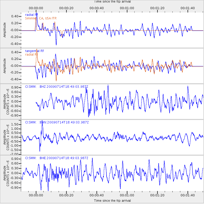
SMM Simmler, CA, USA - Earthquake Result Viewer
*The percent match for this event was below the threshold and hence no stack was calculated.
| Earthquake location: |
Chile-Bolivia Border Region |
| Earthquake latitude/longitude: |
-21.8/-67.1 |
| Earthquake time(UTC): |
2009/07/14 (195) 18:38:08 GMT |
| Earthquake Depth: |
176 km |
| Earthquake Magnitude: |
5.7 MW, 5.4 MB, 5.7 MW |
| Earthquake Catalog/Contributor: |
WHDF/NEIC |
|
| Network: |
CI Caltech Regional Seismic Network |
| Station: |
SMM Simmler, CA, USA |
| Lat/Lon: |
35.31 N/120.00 W |
| Elevation: |
599 m |
|
| Distance: |
75.8 deg |
| Az: |
317.703 deg |
| Baz: |
130.126 deg |
| Ray Param: |
$rayparam |
*The percent match for this event was below the threshold and hence was not used in the summary stack. |
|
| Radial Match: |
64.05877 % |
| Radial Bump: |
400 |
| Transverse Match: |
68.09944 % |
| Transverse Bump: |
400 |
| SOD ConfigId: |
2648 |
| Insert Time: |
2010-02-26 01:31:24.655 +0000 |
| GWidth: |
2.5 |
| Max Bumps: |
400 |
| Tol: |
0.001 |
|
Signal To Noise
| Channel | StoN | STA | LTA |
| CI:SMM: :BHN:20090714T18:49:03.987Z | 3.16825 | 7.580478E-7 | 2.392639E-7 |
| CI:SMM: :BHE:20090714T18:49:03.987Z | 1.241984 | 4.0165875E-7 | 3.234009E-7 |
| CI:SMM: :BHZ:20090714T18:49:03.987Z | 2.123159 | 4.894355E-7 | 2.3052229E-7 |
| Arrivals |
| Ps | |
| PpPs | |
| PsPs/PpSs | |


