You are here: Home > Network List > TA - USArray Transportable Network (new EarthScope stations) Stations List
> Station D15A Lincoln, MT, USA > Earthquake Result Viewer
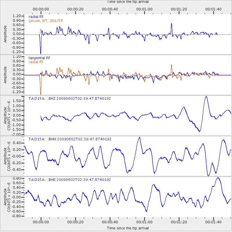
D15A Lincoln, MT, USA - Earthquake Result Viewer
*The percent match for this event was below the threshold and hence no stack was calculated.
| Earthquake location: |
Vanuatu Islands |
| Earthquake latitude/longitude: |
-17.8/167.9 |
| Earthquake time(UTC): |
2009/06/02 (153) 02:26:53 GMT |
| Earthquake Depth: |
15 km |
| Earthquake Magnitude: |
5.5 MB |
| Earthquake Catalog/Contributor: |
WHDF/NEIC |
|
| Network: |
TA USArray Transportable Network (new EarthScope stations) |
| Station: |
D15A Lincoln, MT, USA |
| Lat/Lon: |
47.04 N/112.52 W |
| Elevation: |
1593 m |
|
| Distance: |
96.0 deg |
| Az: |
42.561 deg |
| Baz: |
250.464 deg |
| Ray Param: |
$rayparam |
*The percent match for this event was below the threshold and hence was not used in the summary stack. |
|
| Radial Match: |
55.889786 % |
| Radial Bump: |
400 |
| Transverse Match: |
55.210487 % |
| Transverse Bump: |
400 |
| SOD ConfigId: |
2648 |
| Insert Time: |
2010-03-06 05:04:34.323 +0000 |
| GWidth: |
2.5 |
| Max Bumps: |
400 |
| Tol: |
0.001 |
|
Signal To Noise
| Channel | StoN | STA | LTA |
| TA:D15A: :BHN:20090602T02:39:47.874019Z | 0.5907259 | 1.2488935E-7 | 2.1141676E-7 |
| TA:D15A: :BHE:20090602T02:39:47.874019Z | 4.378201 | 3.9948557E-7 | 9.124423E-8 |
| TA:D15A: :BHZ:20090602T02:39:47.874019Z | 1.1213033 | 2.3516856E-7 | 2.0972789E-7 |
| Arrivals |
| Ps | |
| PpPs | |
| PsPs/PpSs | |


