You are here: Home > Network List > TA - USArray Transportable Network (new EarthScope stations) Stations List
> Station F20K Avaraart Lake, AK, USA > Earthquake Result Viewer
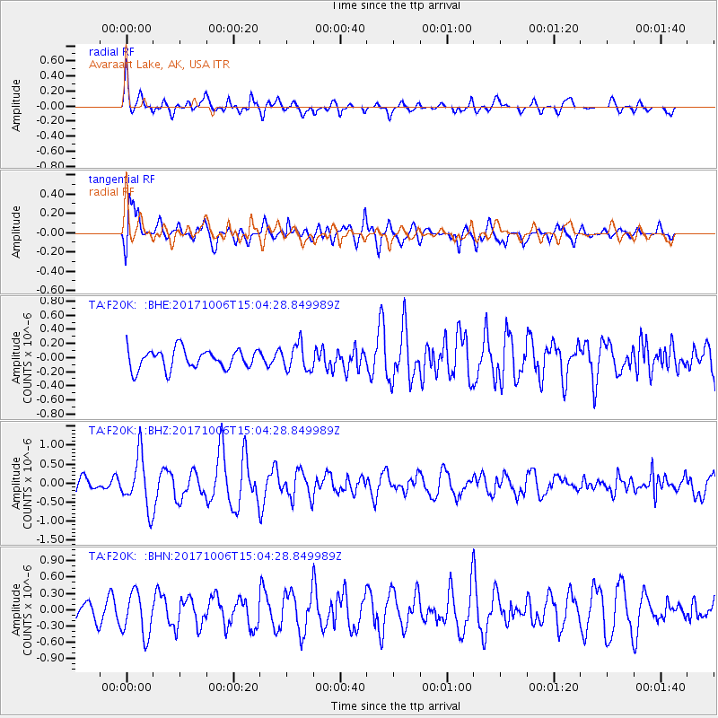
F20K Avaraart Lake, AK, USA - Earthquake Result Viewer
*The percent match for this event was below the threshold and hence no stack was calculated.
| Earthquake location: |
Near East Coast Of Honshu, Japan |
| Earthquake latitude/longitude: |
37.1/141.2 |
| Earthquake time(UTC): |
2017/10/06 (279) 14:56:40 GMT |
| Earthquake Depth: |
47 km |
| Earthquake Magnitude: |
5.4 Mww |
| Earthquake Catalog/Contributor: |
NEIC PDE/us |
|
| Network: |
TA USArray Transportable Network (new EarthScope stations) |
| Station: |
F20K Avaraart Lake, AK, USA |
| Lat/Lon: |
67.05 N/155.73 W |
| Elevation: |
136 m |
|
| Distance: |
46.0 deg |
| Az: |
29.077 deg |
| Baz: |
262.215 deg |
| Ray Param: |
$rayparam |
*The percent match for this event was below the threshold and hence was not used in the summary stack. |
|
| Radial Match: |
70.27252 % |
| Radial Bump: |
400 |
| Transverse Match: |
78.31981 % |
| Transverse Bump: |
400 |
| SOD ConfigId: |
13570011 |
| Insert Time: |
2019-04-28 22:54:05.323 +0000 |
| GWidth: |
2.5 |
| Max Bumps: |
400 |
| Tol: |
0.001 |
|
Signal To Noise
| Channel | StoN | STA | LTA |
| TA:F20K: :BHZ:20171006T15:04:28.849989Z | 4.343905 | 6.902036E-7 | 1.5889012E-7 |
| TA:F20K: :BHN:20171006T15:04:28.849989Z | 2.261286 | 3.991881E-7 | 1.7653146E-7 |
| TA:F20K: :BHE:20171006T15:04:28.849989Z | 1.3463043 | 1.8533265E-7 | 1.3766031E-7 |
| Arrivals |
| Ps | |
| PpPs | |
| PsPs/PpSs | |


