You are here: Home > Network List > TA - USArray Transportable Network (new EarthScope stations) Stations List
> Station G21K Allakaket, AK, USA > Earthquake Result Viewer
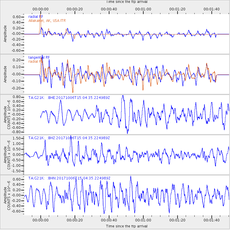
G21K Allakaket, AK, USA - Earthquake Result Viewer
*The percent match for this event was below the threshold and hence no stack was calculated.
| Earthquake location: |
Near East Coast Of Honshu, Japan |
| Earthquake latitude/longitude: |
37.1/141.2 |
| Earthquake time(UTC): |
2017/10/06 (279) 14:56:40 GMT |
| Earthquake Depth: |
47 km |
| Earthquake Magnitude: |
5.4 Mww |
| Earthquake Catalog/Contributor: |
NEIC PDE/us |
|
| Network: |
TA USArray Transportable Network (new EarthScope stations) |
| Station: |
G21K Allakaket, AK, USA |
| Lat/Lon: |
66.52 N/153.51 W |
| Elevation: |
446 m |
|
| Distance: |
46.8 deg |
| Az: |
29.948 deg |
| Baz: |
264.853 deg |
| Ray Param: |
$rayparam |
*The percent match for this event was below the threshold and hence was not used in the summary stack. |
|
| Radial Match: |
60.55344 % |
| Radial Bump: |
400 |
| Transverse Match: |
59.538685 % |
| Transverse Bump: |
400 |
| SOD ConfigId: |
13570011 |
| Insert Time: |
2019-04-28 22:54:11.592 +0000 |
| GWidth: |
2.5 |
| Max Bumps: |
400 |
| Tol: |
0.001 |
|
Signal To Noise
| Channel | StoN | STA | LTA |
| TA:G21K: :BHZ:20171006T15:04:35.224989Z | 2.601056 | 5.5039914E-7 | 2.1160602E-7 |
| TA:G21K: :BHN:20171006T15:04:35.224989Z | 1.272962 | 2.4904372E-7 | 1.9564114E-7 |
| TA:G21K: :BHE:20171006T15:04:35.224989Z | 0.81987894 | 1.9158672E-7 | 2.3367683E-7 |
| Arrivals |
| Ps | |
| PpPs | |
| PsPs/PpSs | |


