You are here: Home > Network List > TA - USArray Transportable Network (new EarthScope stations) Stations List
> Station MDND Maddock, ND, USA > Earthquake Result Viewer
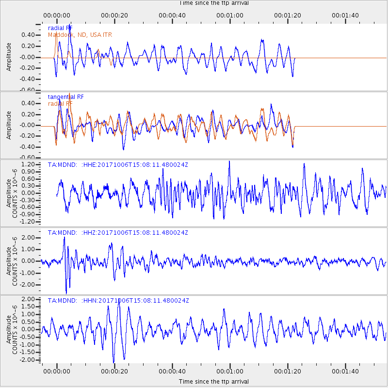
MDND Maddock, ND, USA - Earthquake Result Viewer
*The percent match for this event was below the threshold and hence no stack was calculated.
| Earthquake location: |
Near East Coast Of Honshu, Japan |
| Earthquake latitude/longitude: |
37.1/141.2 |
| Earthquake time(UTC): |
2017/10/06 (279) 14:56:40 GMT |
| Earthquake Depth: |
47 km |
| Earthquake Magnitude: |
5.4 Mww |
| Earthquake Catalog/Contributor: |
NEIC PDE/us |
|
| Network: |
TA USArray Transportable Network (new EarthScope stations) |
| Station: |
MDND Maddock, ND, USA |
| Lat/Lon: |
47.85 N/99.60 W |
| Elevation: |
479 m |
|
| Distance: |
79.6 deg |
| Az: |
36.718 deg |
| Baz: |
314.792 deg |
| Ray Param: |
$rayparam |
*The percent match for this event was below the threshold and hence was not used in the summary stack. |
|
| Radial Match: |
58.903893 % |
| Radial Bump: |
400 |
| Transverse Match: |
61.56778 % |
| Transverse Bump: |
400 |
| SOD ConfigId: |
13570011 |
| Insert Time: |
2019-04-28 22:54:38.041 +0000 |
| GWidth: |
2.5 |
| Max Bumps: |
400 |
| Tol: |
0.001 |
|
Signal To Noise
| Channel | StoN | STA | LTA |
| TA:MDND: :HHZ:20171006T15:08:11.480024Z | 5.462527 | 1.0623377E-6 | 1.9447734E-7 |
| TA:MDND: :HHN:20171006T15:08:11.480024Z | 0.63550097 | 2.8468446E-7 | 4.4796857E-7 |
| TA:MDND: :HHE:20171006T15:08:11.480024Z | 1.3314666 | 3.919213E-7 | 2.943531E-7 |
| Arrivals |
| Ps | |
| PpPs | |
| PsPs/PpSs | |


