You are here: Home > Network List > IU - Global Seismograph Network (GSN - IRIS/USGS) Stations List
> Station XMAS Kiritimati Island, Republic of Kiribati > Earthquake Result Viewer
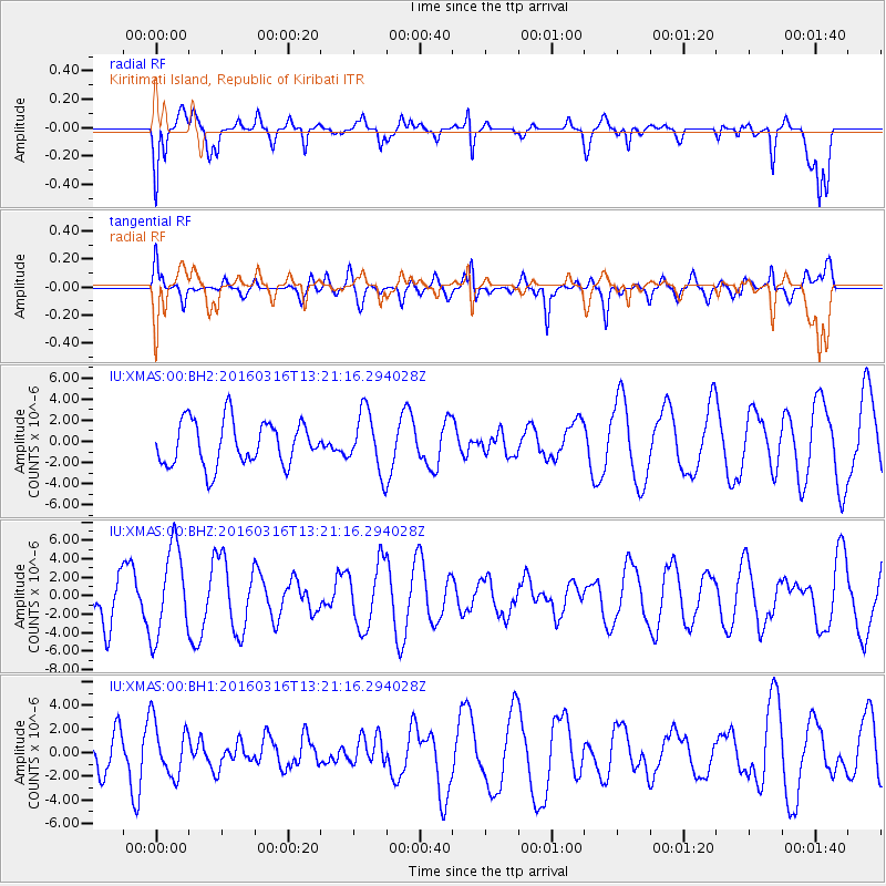
XMAS Kiritimati Island, Republic of Kiribati - Earthquake Result Viewer
*The percent match for this event was below the threshold and hence no stack was calculated.
| Earthquake location: |
Talaud Islands, Indonesia |
| Earthquake latitude/longitude: |
4.7/125.1 |
| Earthquake time(UTC): |
2016/03/16 (076) 13:09:52 GMT |
| Earthquake Depth: |
10 km |
| Earthquake Magnitude: |
5.6 MB |
| Earthquake Catalog/Contributor: |
NEIC PDE/NEIC COMCAT |
|
| Network: |
IU Global Seismograph Network (GSN - IRIS/USGS) |
| Station: |
XMAS Kiritimati Island, Republic of Kiribati |
| Lat/Lon: |
2.04 N/157.45 W |
| Elevation: |
20 m |
|
| Distance: |
77.4 deg |
| Az: |
88.951 deg |
| Baz: |
274.281 deg |
| Ray Param: |
$rayparam |
*The percent match for this event was below the threshold and hence was not used in the summary stack. |
|
| Radial Match: |
66.66857 % |
| Radial Bump: |
400 |
| Transverse Match: |
54.428677 % |
| Transverse Bump: |
400 |
| SOD ConfigId: |
1453031 |
| Insert Time: |
2016-03-30 13:34:51.247 +0000 |
| GWidth: |
2.5 |
| Max Bumps: |
400 |
| Tol: |
0.001 |
|
Signal To Noise
| Channel | StoN | STA | LTA |
| IU:XMAS:00:BHZ:20160316T13:21:16.294028Z | 2.0358646 | 4.798819E-6 | 2.3571406E-6 |
| IU:XMAS:00:BH1:20160316T13:21:16.294028Z | 1.0756476 | 2.2803747E-6 | 2.1200017E-6 |
| IU:XMAS:00:BH2:20160316T13:21:16.294028Z | 1.3379014 | 2.8003737E-6 | 2.0931093E-6 |
| Arrivals |
| Ps | |
| PpPs | |
| PsPs/PpSs | |


