You are here: Home > Network List > CI - Caltech Regional Seismic Network Stations List
> Station SMM Simmler, CA, USA > Earthquake Result Viewer
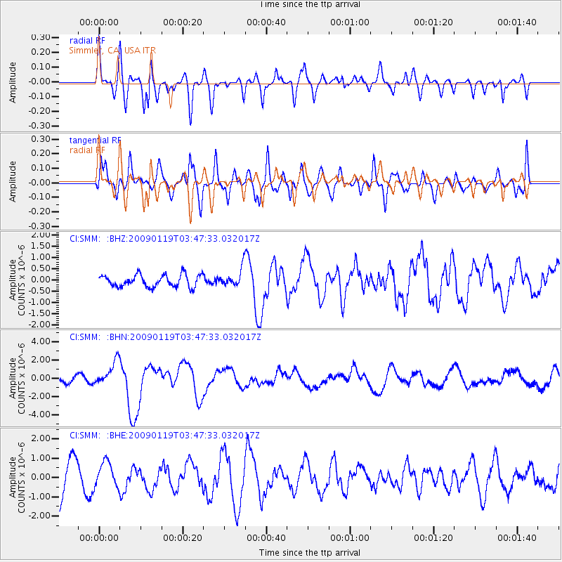
SMM Simmler, CA, USA - Earthquake Result Viewer
*The percent match for this event was below the threshold and hence no stack was calculated.
| Earthquake location: |
Southeast Of Loyalty Islands |
| Earthquake latitude/longitude: |
-22.6/170.9 |
| Earthquake time(UTC): |
2009/01/19 (019) 03:35:18 GMT |
| Earthquake Depth: |
12 km |
| Earthquake Magnitude: |
5.7 MB, 6.4 MS, 6.5 MW, 6.5 MW |
| Earthquake Catalog/Contributor: |
WHDF/NEIC |
|
| Network: |
CI Caltech Regional Seismic Network |
| Station: |
SMM Simmler, CA, USA |
| Lat/Lon: |
35.31 N/120.00 W |
| Elevation: |
599 m |
|
| Distance: |
87.1 deg |
| Az: |
49.901 deg |
| Baz: |
239.812 deg |
| Ray Param: |
$rayparam |
*The percent match for this event was below the threshold and hence was not used in the summary stack. |
|
| Radial Match: |
70.34078 % |
| Radial Bump: |
400 |
| Transverse Match: |
44.225887 % |
| Transverse Bump: |
400 |
| SOD ConfigId: |
2658 |
| Insert Time: |
2010-02-26 01:31:27.550 +0000 |
| GWidth: |
2.5 |
| Max Bumps: |
400 |
| Tol: |
0.001 |
|
Signal To Noise
| Channel | StoN | STA | LTA |
| CI:SMM: :BHN:20090119T03:47:33.032017Z | 4.430519 | 1.3780764E-6 | 3.1104173E-7 |
| CI:SMM: :BHE:20090119T03:47:33.032017Z | 0.6681028 | 6.350721E-7 | 9.5056043E-7 |
| CI:SMM: :BHZ:20090119T03:47:33.032017Z | 1.5928679 | 4.2532437E-7 | 2.67018E-7 |
| Arrivals |
| Ps | |
| PpPs | |
| PsPs/PpSs | |


