You are here: Home > Network List > TA - USArray Transportable Network (new EarthScope stations) Stations List
> Station D15A Lincoln, MT, USA > Earthquake Result Viewer
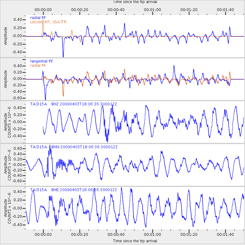
D15A Lincoln, MT, USA - Earthquake Result Viewer
*The percent match for this event was below the threshold and hence no stack was calculated.
| Earthquake location: |
Catamarca Province, Argentina |
| Earthquake latitude/longitude: |
-27.8/-66.6 |
| Earthquake time(UTC): |
2009/04/03 (093) 17:54:50 GMT |
| Earthquake Depth: |
174 km |
| Earthquake Magnitude: |
5.7 MW, 5.3 MB, 5.7 MW |
| Earthquake Catalog/Contributor: |
WHDF/NEIC |
|
| Network: |
TA USArray Transportable Network (new EarthScope stations) |
| Station: |
D15A Lincoln, MT, USA |
| Lat/Lon: |
47.04 N/112.52 W |
| Elevation: |
1593 m |
|
| Distance: |
85.3 deg |
| Az: |
330.46 deg |
| Baz: |
140.329 deg |
| Ray Param: |
$rayparam |
*The percent match for this event was below the threshold and hence was not used in the summary stack. |
|
| Radial Match: |
65.3418 % |
| Radial Bump: |
400 |
| Transverse Match: |
73.34802 % |
| Transverse Bump: |
400 |
| SOD ConfigId: |
2658 |
| Insert Time: |
2010-03-06 05:05:24.356 +0000 |
| GWidth: |
2.5 |
| Max Bumps: |
400 |
| Tol: |
0.001 |
|
Signal To Noise
| Channel | StoN | STA | LTA |
| TA:D15A: :BHN:20090403T18:06:36.300012Z | 3.1389067 | 3.6611436E-7 | 1.1663754E-7 |
| TA:D15A: :BHE:20090403T18:06:36.300012Z | 0.75919086 | 1.5583898E-7 | 2.0526984E-7 |
| TA:D15A: :BHZ:20090403T18:06:36.300012Z | 1.4570007 | 2.8932578E-7 | 1.9857629E-7 |
| Arrivals |
| Ps | |
| PpPs | |
| PsPs/PpSs | |


