You are here: Home > Network List > TA - USArray Transportable Network (new EarthScope stations) Stations List
> Station D15A Lincoln, MT, USA > Earthquake Result Viewer
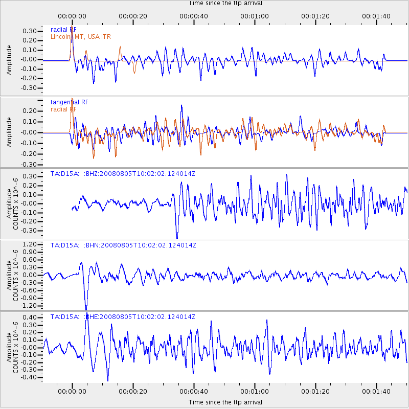
D15A Lincoln, MT, USA - Earthquake Result Viewer
*The percent match for this event was below the threshold and hence no stack was calculated.
| Earthquake location: |
Sichuan, China |
| Earthquake latitude/longitude: |
32.8/105.5 |
| Earthquake time(UTC): |
2008/08/05 (218) 09:49:17 GMT |
| Earthquake Depth: |
6.0 km |
| Earthquake Magnitude: |
5.9 MB, 6.0 MS, 6.0 MW, 5.9 MW |
| Earthquake Catalog/Contributor: |
WHDF/NEIC |
|
| Network: |
TA USArray Transportable Network (new EarthScope stations) |
| Station: |
D15A Lincoln, MT, USA |
| Lat/Lon: |
47.04 N/112.52 W |
| Elevation: |
1593 m |
|
| Distance: |
93.5 deg |
| Az: |
24.96 deg |
| Baz: |
328.673 deg |
| Ray Param: |
$rayparam |
*The percent match for this event was below the threshold and hence was not used in the summary stack. |
|
| Radial Match: |
59.547535 % |
| Radial Bump: |
400 |
| Transverse Match: |
70.11115 % |
| Transverse Bump: |
400 |
| SOD ConfigId: |
2658 |
| Insert Time: |
2010-03-06 05:05:27.354 +0000 |
| GWidth: |
2.5 |
| Max Bumps: |
400 |
| Tol: |
0.001 |
|
Signal To Noise
| Channel | StoN | STA | LTA |
| TA:D15A: :BHN:20080805T10:02:02.124014Z | 8.946836 | 5.0565063E-7 | 5.651725E-8 |
| TA:D15A: :BHE:20080805T10:02:02.124014Z | 2.2912178 | 1.5822722E-7 | 6.905813E-8 |
| TA:D15A: :BHZ:20080805T10:02:02.124014Z | 3.9349701 | 1.3498175E-7 | 3.430312E-8 |
| Arrivals |
| Ps | |
| PpPs | |
| PsPs/PpSs | |


