You are here: Home > Network List > CI - Caltech Regional Seismic Network Stations List
> Station SMM Simmler, CA, USA > Earthquake Result Viewer
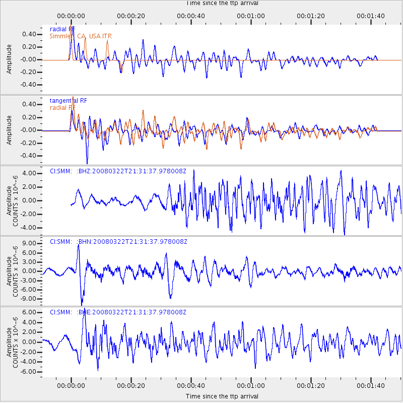
SMM Simmler, CA, USA - Earthquake Result Viewer
*The percent match for this event was below the threshold and hence no stack was calculated.
| Earthquake location: |
Andreanof Islands, Aleutian Is. |
| Earthquake latitude/longitude: |
52.2/-178.7 |
| Earthquake time(UTC): |
2008/03/22 (082) 21:24:11 GMT |
| Earthquake Depth: |
132 km |
| Earthquake Magnitude: |
5.8 MB, 6.2 MW, 6.1 MW |
| Earthquake Catalog/Contributor: |
WHDF/NEIC |
|
| Network: |
CI Caltech Regional Seismic Network |
| Station: |
SMM Simmler, CA, USA |
| Lat/Lon: |
35.31 N/120.00 W |
| Elevation: |
599 m |
|
| Distance: |
44.4 deg |
| Az: |
88.376 deg |
| Baz: |
311.177 deg |
| Ray Param: |
$rayparam |
*The percent match for this event was below the threshold and hence was not used in the summary stack. |
|
| Radial Match: |
78.12002 % |
| Radial Bump: |
400 |
| Transverse Match: |
83.27957 % |
| Transverse Bump: |
400 |
| SOD ConfigId: |
2504 |
| Insert Time: |
2010-02-26 01:31:29.613 +0000 |
| GWidth: |
2.5 |
| Max Bumps: |
400 |
| Tol: |
0.001 |
|
Signal To Noise
| Channel | StoN | STA | LTA |
| CI:SMM: :BHN:20080322T21:31:37.978008Z | 9.297135 | 4.9296136E-6 | 5.3022933E-7 |
| CI:SMM: :BHE:20080322T21:31:37.978008Z | 5.1906276 | 2.980944E-6 | 5.7429355E-7 |
| CI:SMM: :BHZ:20080322T21:31:37.978008Z | 1.893713 | 1.0959446E-6 | 5.787279E-7 |
| Arrivals |
| Ps | |
| PpPs | |
| PsPs/PpSs | |


