
G14A Jackson, MT, USA - Earthquake Result Viewer
| ||||||||||||||||||
| ||||||||||||||||||
| ||||||||||||||||||
|
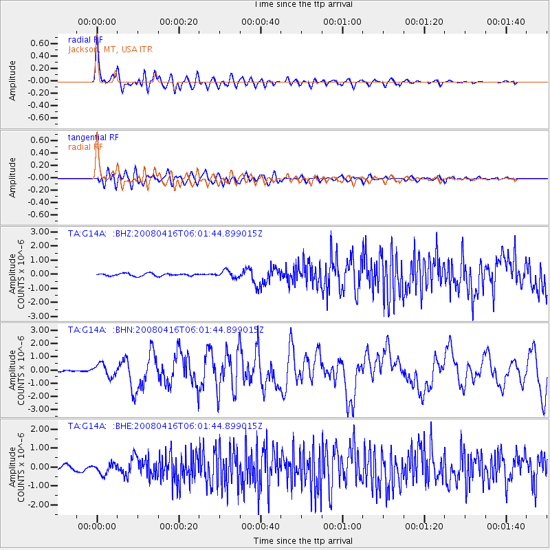
Signal To Noise
| Channel | StoN | STA | LTA |
| TA:G14A: :BHN:20080416T06:01:44.899015Z | 5.0728917 | 4.9013903E-7 | 9.661926E-8 |
| TA:G14A: :BHE:20080416T06:01:44.899015Z | 1.9394668 | 2.7467357E-7 | 1.4162322E-7 |
| TA:G14A: :BHZ:20080416T06:01:44.899015Z | 2.991523 | 2.5889958E-7 | 8.6544404E-8 |
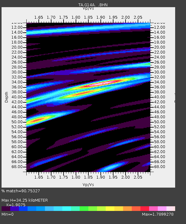
| Arrivals | |
| Ps | 5.0 SECOND |
| PpPs | 14 SECOND |
| PsPs/PpSs | 19 SECOND |

