
G14A Jackson, MT, USA - Earthquake Result Viewer
| ||||||||||||||||||
| ||||||||||||||||||
| ||||||||||||||||||
|
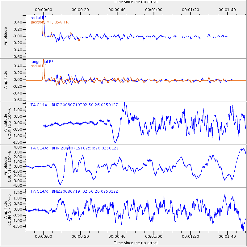
Signal To Noise
| Channel | StoN | STA | LTA |
| TA:G14A: :BHN:20080719T02:50:26.025012Z | 2.0947478 | 2.2702754E-7 | 1.0837942E-7 |
| TA:G14A: :BHE:20080719T02:50:26.025012Z | 1.9027327 | 1.1458025E-7 | 6.021878E-8 |
| TA:G14A: :BHZ:20080719T02:50:26.025012Z | 2.0857127 | 1.8279444E-7 | 8.764123E-8 |
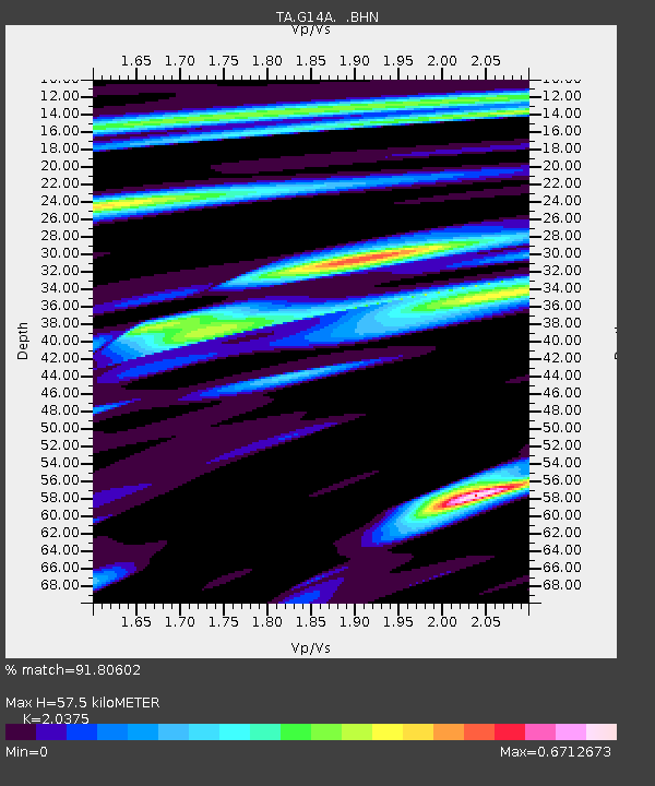
| Arrivals | |
| Ps | 9.4 SECOND |
| PpPs | 26 SECOND |
| PsPs/PpSs | 35 SECOND |

