
G14A Jackson, MT, USA - Earthquake Result Viewer
| ||||||||||||||||||
| ||||||||||||||||||
| ||||||||||||||||||
|
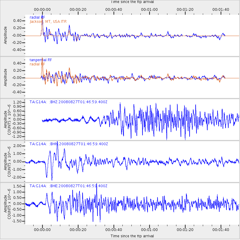
Signal To Noise
| Channel | StoN | STA | LTA |
| TA:G14A: :BHN:20080827T01:46:59.400Z | 12.053034 | 8.4217373E-7 | 6.987234E-8 |
| TA:G14A: :BHE:20080827T01:46:59.400Z | 6.135504 | 3.7480316E-7 | 6.108759E-8 |
| TA:G14A: :BHZ:20080827T01:46:59.400Z | 2.4833157 | 1.9033473E-7 | 7.66454E-8 |
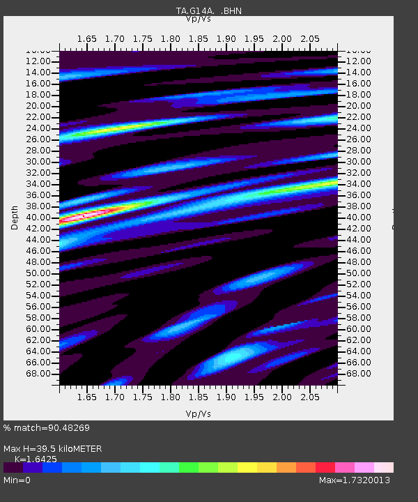
| Arrivals | |
| Ps | 4.0 SECOND |
| PpPs | 15 SECOND |
| PsPs/PpSs | 19 SECOND |

