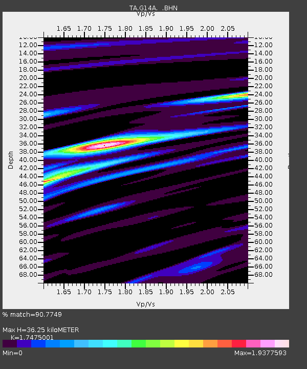
G14A Jackson, MT, USA - Earthquake Result Viewer
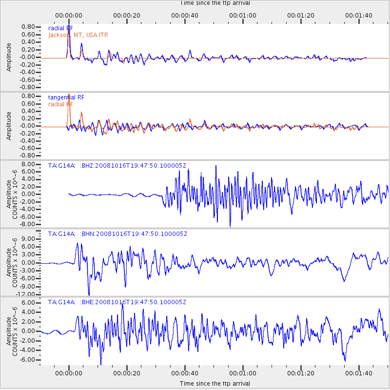
Earthquake location: Near Coast Of Chiapas, Mexico
Earthquake latitude/longitude: 14.4/-92.4
Earthquake time(UTC): 2008/10/16 (290) 19:41:25 GMT
Earthquake Depth: 24 km
Earthquake Magnitude: 6.1 MB, 6.6 MS, 6.7 MW, 6.6 MW
Earthquake Catalog/Contributor: WHDF/NEIC
Network: TA USArray Transportable Network (new EarthScope stations)
Station: G14A Jackson, MT, USA
Lat/Lon: 45.24 N/113.46 W
Elevation: 2140 m
Distance: 35.5 deg
Az: 334.052 deg
Baz: 143.124 deg
Ray Param: 0.077137254
Estimated Moho Depth: 36.25 km
Estimated Crust Vp/Vs: 1.75
Assumed Crust Vp: 6.577 km/s
Estimated Crust Vs: 3.764 km/s
Estimated Crust Poisson's Ratio: 0.26
Radial Match: 90.7749 %
Radial Bump: 400
Transverse Match: 82.77744 %
Transverse Bump: 400
SOD ConfigId: 2556
Insert Time: 2010-03-06 05:06:20.207 +0000
GWidth: 2.5
Max Bumps: 400
Tol: 0.001

Signal To Noise

ChannelStoNSTALTA
TA:G14A: :BHN:20081016T19:47:50.100005Z23.4161453.3256222E-61.4202261E-7
TA:G14A: :BHE:20081016T19:47:50.100005Z10.4998981.5403529E-61.4670171E-7
TA:G14A: :BHZ:20081016T19:47:50.100005Z7.8172431.4493595E-61.8540545E-7
Arrivals
Ps4.5 SECOND
PpPs14 SECOND
PsPs/PpSs18 SECOND