You are here: Home > Network List > CI - Caltech Regional Seismic Network Stations List
> Station SMM Simmler, CA, USA > Earthquake Result Viewer
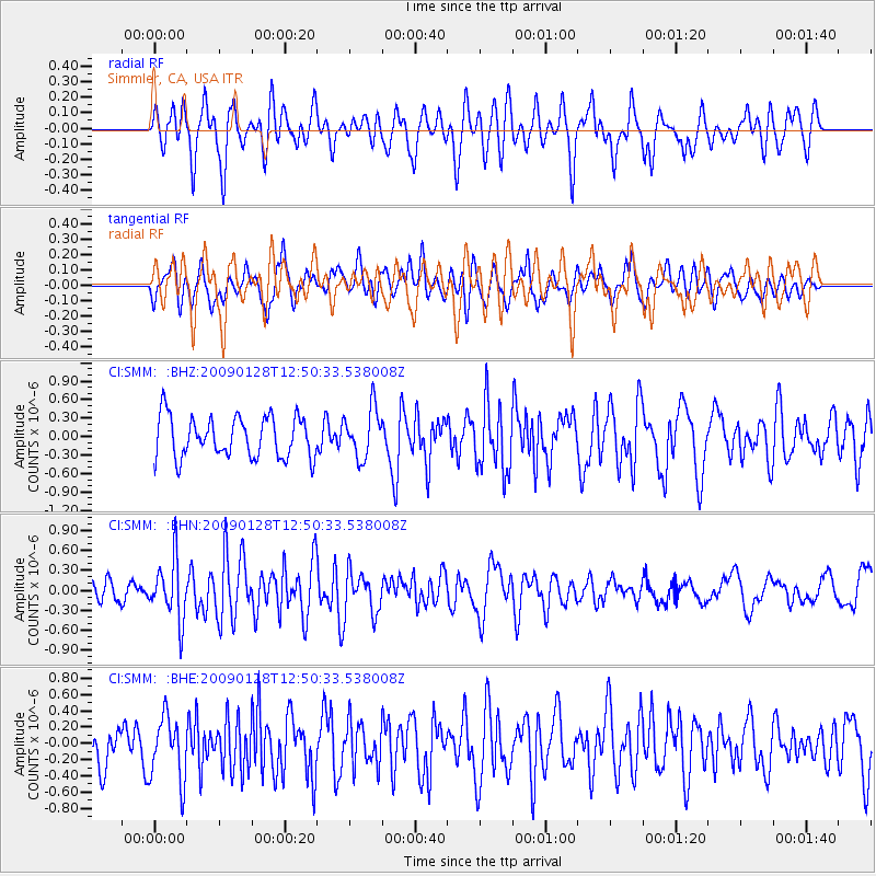
SMM Simmler, CA, USA - Earthquake Result Viewer
*The percent match for this event was below the threshold and hence no stack was calculated.
| Earthquake location: |
Samoa Islands Region |
| Earthquake latitude/longitude: |
-17.0/-172.1 |
| Earthquake time(UTC): |
2009/01/28 (028) 12:39:42 GMT |
| Earthquake Depth: |
10 km |
| Earthquake Magnitude: |
5.6 MB, 5.3 MS, 5.5 MW |
| Earthquake Catalog/Contributor: |
WHDF/NEIC |
|
| Network: |
CI Caltech Regional Seismic Network |
| Station: |
SMM Simmler, CA, USA |
| Lat/Lon: |
35.31 N/120.00 W |
| Elevation: |
599 m |
|
| Distance: |
71.7 deg |
| Az: |
42.802 deg |
| Baz: |
232.665 deg |
| Ray Param: |
$rayparam |
*The percent match for this event was below the threshold and hence was not used in the summary stack. |
|
| Radial Match: |
74.29911 % |
| Radial Bump: |
400 |
| Transverse Match: |
52.141323 % |
| Transverse Bump: |
400 |
| SOD ConfigId: |
2658 |
| Insert Time: |
2010-02-26 01:31:32.843 +0000 |
| GWidth: |
2.5 |
| Max Bumps: |
400 |
| Tol: |
0.001 |
|
Signal To Noise
| Channel | StoN | STA | LTA |
| CI:SMM: :BHN:20090128T12:50:33.538008Z | 2.374196 | 4.4627387E-7 | 1.8796842E-7 |
| CI:SMM: :BHE:20090128T12:50:33.538008Z | 1.6455244 | 3.9210715E-7 | 2.3828704E-7 |
| CI:SMM: :BHZ:20090128T12:50:33.538008Z | 1.2167279 | 4.0291172E-7 | 3.3114367E-7 |
| Arrivals |
| Ps | |
| PpPs | |
| PsPs/PpSs | |


