You are here: Home > Network List > CI - Caltech Regional Seismic Network Stations List
> Station MPP McPhearson Peak > Earthquake Result Viewer
MPP McPhearson Peak - Earthquake Result Viewer
*The percent match for this event was below the threshold and hence no stack was calculated.
| Earthquake location: |
Rat Islands, Aleutian Islands |
| Earthquake latitude/longitude: |
52.4/176.8 |
| Earthquake time(UTC): |
2017/10/08 (281) 22:34:33 GMT |
| Earthquake Depth: |
112 km |
| Earthquake Magnitude: |
6.6 mww |
| Earthquake Catalog/Contributor: |
NEIC PDE/us |
|
| Network: |
CI Caltech Regional Seismic Network |
| Station: |
MPP McPhearson Peak |
| Lat/Lon: |
34.89 N/119.81 W |
| Elevation: |
1739 m |
|
| Distance: |
47.5 deg |
| Az: |
85.551 deg |
| Baz: |
312.075 deg |
| Ray Param: |
$rayparam |
*The percent match for this event was below the threshold and hence was not used in the summary stack. |
|
| Radial Match: |
67.81085 % |
| Radial Bump: |
400 |
| Transverse Match: |
64.24658 % |
| Transverse Bump: |
400 |
| SOD ConfigId: |
13570011 |
| Insert Time: |
2019-04-28 23:11:25.190 +0000 |
| GWidth: |
2.5 |
| Max Bumps: |
400 |
| Tol: |
0.001 |
|
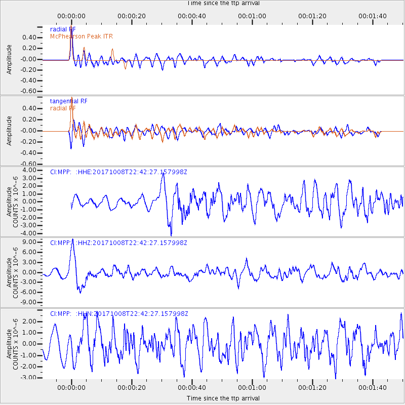
Signal To Noise
| Channel | StoN | STA | LTA |
| CI:MPP: :HHZ:20171008T22:42:27.157998Z | 10.235039 | 5.3118792E-6 | 5.189896E-7 |
| CI:MPP: :HHN:20171008T22:42:27.157998Z | 2.0056875 | 1.3864085E-6 | 6.9123854E-7 |
| CI:MPP: :HHE:20171008T22:42:27.157998Z | 4.537864 | 2.3261368E-6 | 5.126061E-7 |
| Arrivals |
| Ps | |
| PpPs | |
| PsPs/PpSs | |


