You are here: Home > Network List > CI - Caltech Regional Seismic Network Stations List
> Station SMM Simmler, CA, USA > Earthquake Result Viewer
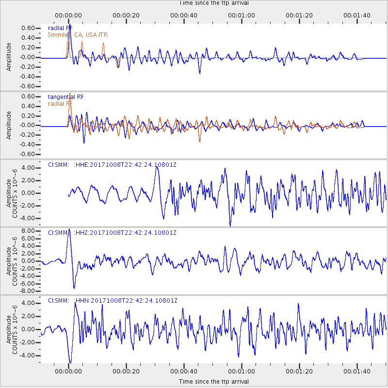
SMM Simmler, CA, USA - Earthquake Result Viewer
*The percent match for this event was below the threshold and hence no stack was calculated.
| Earthquake location: |
Rat Islands, Aleutian Islands |
| Earthquake latitude/longitude: |
52.4/176.8 |
| Earthquake time(UTC): |
2017/10/08 (281) 22:34:33 GMT |
| Earthquake Depth: |
112 km |
| Earthquake Magnitude: |
6.6 mww |
| Earthquake Catalog/Contributor: |
NEIC PDE/us |
|
| Network: |
CI Caltech Regional Seismic Network |
| Station: |
SMM Simmler, CA, USA |
| Lat/Lon: |
35.31 N/120.00 W |
| Elevation: |
599 m |
|
| Distance: |
47.1 deg |
| Az: |
85.257 deg |
| Baz: |
311.772 deg |
| Ray Param: |
$rayparam |
*The percent match for this event was below the threshold and hence was not used in the summary stack. |
|
| Radial Match: |
67.444916 % |
| Radial Bump: |
400 |
| Transverse Match: |
64.80653 % |
| Transverse Bump: |
400 |
| SOD ConfigId: |
13570011 |
| Insert Time: |
2019-04-28 23:11:37.605 +0000 |
| GWidth: |
2.5 |
| Max Bumps: |
400 |
| Tol: |
0.001 |
|
Signal To Noise
| Channel | StoN | STA | LTA |
| CI:SMM: :HHZ:20171008T22:42:24.10801Z | 11.89998 | 4.4815233E-6 | 3.7659925E-7 |
| CI:SMM: :HHN:20171008T22:42:24.10801Z | 4.098328 | 2.8015472E-6 | 6.835829E-7 |
| CI:SMM: :HHE:20171008T22:42:24.10801Z | 3.0757468 | 2.540858E-6 | 8.260948E-7 |
| Arrivals |
| Ps | |
| PpPs | |
| PsPs/PpSs | |


